Ever since the Shope Creek area opened up to visitors a few years ago, I’ve been exploring it and poring over the maps to see what might be worth a visit up there. I’ve “found” a few un-documented waterfalls (so to speak) in other areas in the past by looking at the new high-resolution elevation data put out by the USGS.
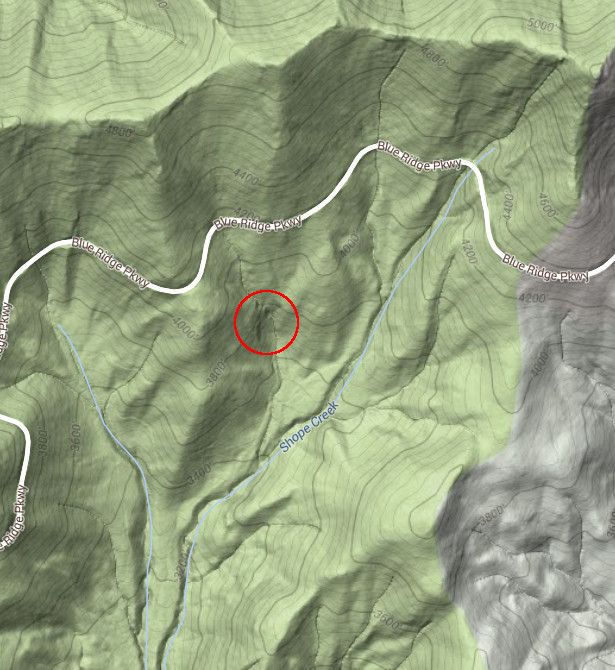
This data is so detailed that, with some good map-making and hill-shading (such as Google Maps’ Terrain layer), you can see “kinks” in stream valleys at nearly every major waterfall in the region where the terrain drops off. It’s like the higher-tech, and higher-accuracy, version of looking for close-together contour lines on the old USGS topo maps.
Well, it turns out that “kinks” on the map can reveal un-documented waterfalls in addition to the well-known ones. And for about a year now, I’ve had my eye on the valley of a tributary of Shope Creek with a “kink” in it. I’d not seen any references to a waterfall this high up in the Shope Creek area, but it was pretty obvious from the maps that there should be one there.

Big, major waterfalls can usually be seen on aerial photos, but the smaller ones tend to be obscured by trees. But where I suspected this waterfall to be, it looked like dark rocks with maybe a small streak of white water on top. Like a waterfall, maybe. Even through the trees.
Trouble is, this little stream is way up on the mountain, just below the Blue Ridge Parkway. Meaning not much room for water to gather before coming over any potential waterfall. And off-trail waterfall hiking in the summer is not always the best idea, with low water, yellowjacket nests, snakes, poison ivy, and leaves obscuring everything. So I held out the summer before making any attempt to explore the area.
Now that the leaves are down, and we got a tremendous rainfall earlier this week, I figured it might be the time to go check it out. The crystal-clear water was really gushing in the main stem of Shope Creek, filling the whole valley with its sound. The early December weather was gorgeous (upper 50’s, at least) as I set out on the now-familiar main trail up to Forrest Falls. It was only a short hop, skip, and a jump beyond that to a short section of off-trail hiking that I was anticipating might be pretty tough as it sometimes can be. But this time, it was easy. I was there in about 20 minutes.
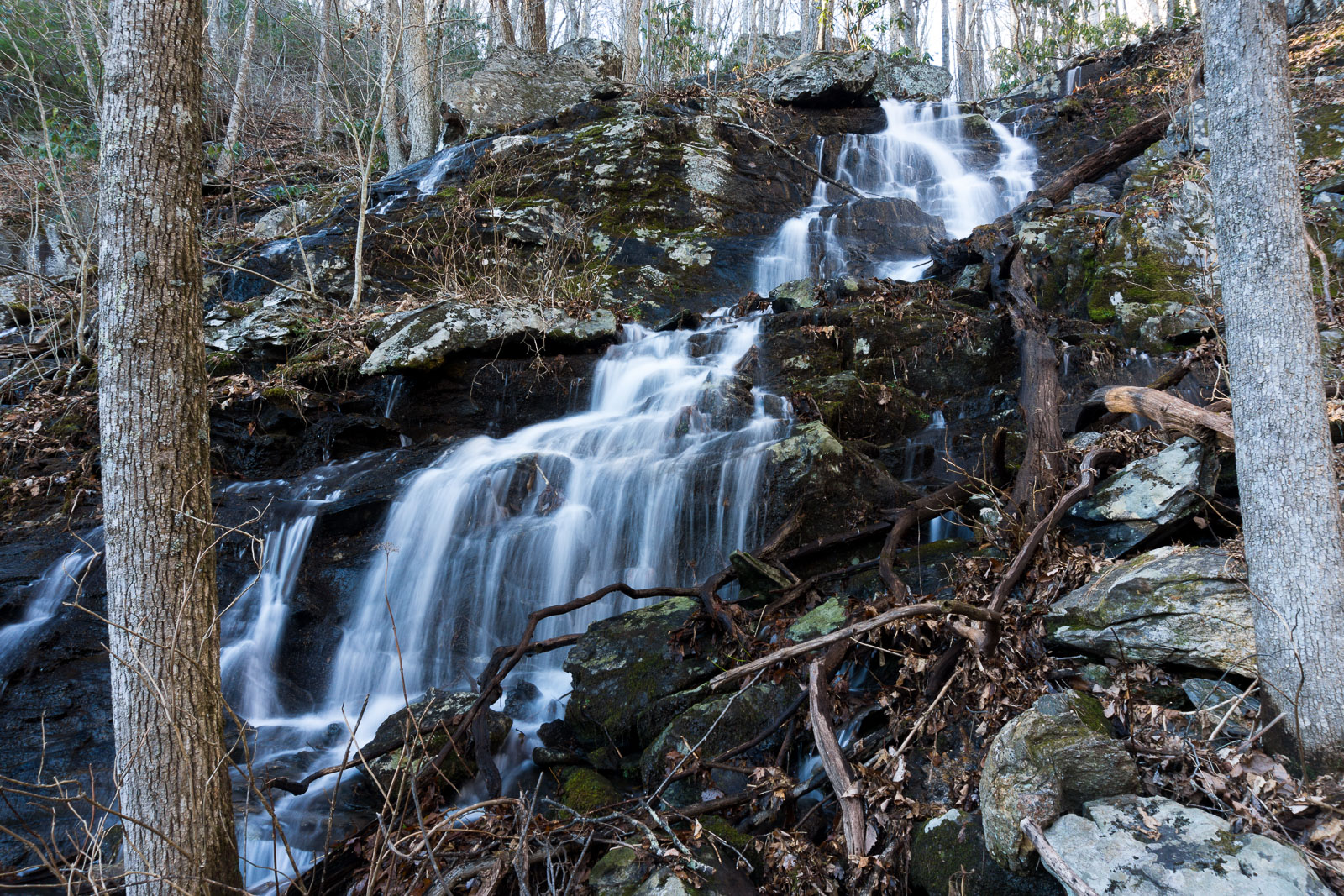
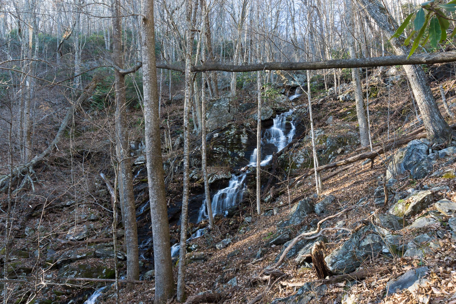
And, it turns out, there is indeed a nice waterfall right where I expected!

It’s not even hard to reach – although it’s about a 1000′ climb from the parking area, it’s a gradual one on well-traveled, if unofficial, trails or mostly clear old logging roads. One of which stops just short of the base of the falls.
I saw no evidence of anyone trampling around at the waterfall before me, and it’s not on any map or publication I’ve ever seen. So I have no idea if it has a name. I’m just calling it Uppermost Falls for now since it’s the highest one up in the Shope Creek area (and every other stream in WNC already has an “Upper” falls). But it’s located below Wolfden Knob, so perhaps Wolfden Falls might work. Let me know if you know its name.

I’ve put it (and all the falls I know about in Shope Creek) on WNCWaterfalls.info. No sense in trying to keep it a secret since a logging road just off a heavily used trail practically leads right to it and it’s only a matter of time before more people start showing up there. If you go, be careful – it’s a bit rough right before the falls and there are no trail signs or blazes to guide you. But I think those who have off-trail waterfall experience will have no particular trouble here and will find it worthwhile – especially after some good rainfall brings the water up!
I didn’t bother to record the track up to the falls, but decided to go ahead and do that on the way back. I explored another “trail” up and over a ridge near the parking area but that part is totally not recommended and not necessary to reach the falls. Just take the main road to where it meets up with the track below at the creek crossing. A full update to our maps of Shope Creek showing this waterfall is coming soon!
[map style=”width: 100%; height: 400px;” gpx=”/wp-content/uploads/2015/12/2015-12-05-Shope-Creek-Uppermost-Falls.gpx”]
Robert Mitchell
Good work sir!
Greg Huffman
Hunting waterfalls. Now that is my kind of hunting?