
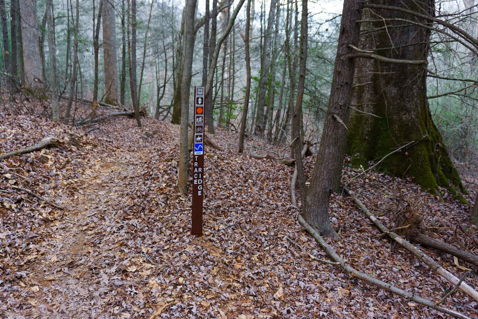
The lower portion of the Trace Ridge Trail, located in the North Mills River area of Pisgah National Forest, has recently been re-routed. It was a years-long project spearheaded by Pisgah Area SORBA, and one of the first volunteer-built sections of significant new trail in these parts of Pisgah National Forest for a while. We had just enough time last weekend to go check it out, and I wanted to re-visit some of the recently logged areas in light of the whole Forest Plan Revision and logging debate that’s going on right now.
So off we went, down North Mills River Road from the huge new Ingles supermarket on NC Hwy. 280, and we parked at the Trace Ridge trailhead parking area.

It was a very warm day for December 13, much like the weather we’d been having all month thanks to El Nino this year. The parking area was packed. FS 479 was closed beyond the turn off onto Hendersonville Reservior Road, which is the road that leads to the Trace Ridge trailhead, and the area around that gate was packed as well – folks like to park there and ride up 479 to loop back on Spencer Gap, Spencer Branch, and/or upper Trace Ridge trails.
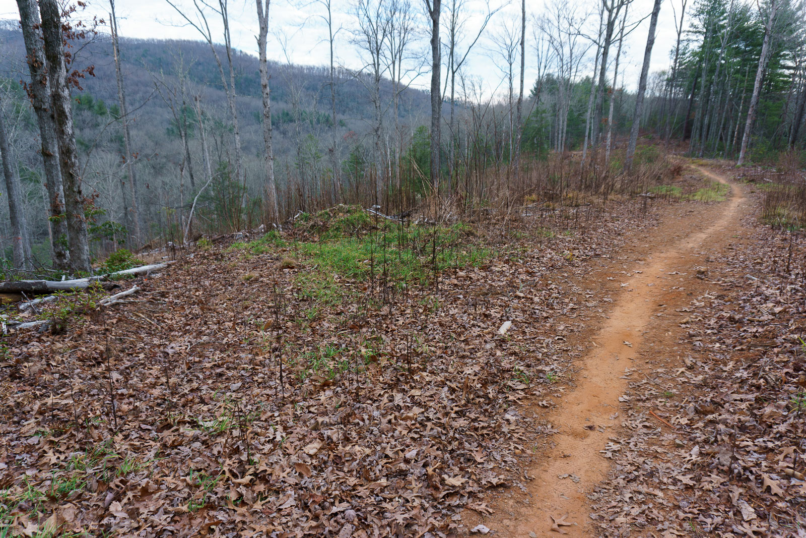
We were on foot today, so we parked as close to the section of trail we were exploring as we could get. The trail starts on the same old road bed as before the reroute, south of the parking area, and it soon entered an area that was logged in 2014. The old road is quickly becoming a singletrack trail again.
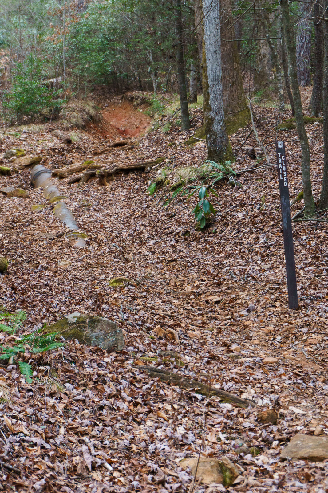
After ambling along a fairly level stretch of trail on the ridge beside the new clearing, the trail re-entered the woods and reached the point where it used to have a junction with the Wash Creek Trail. Formerly, it began a steep, eroded descent toward the river here. But now, the eroded portion straight ahead is closed, and the uppermost portion of the Wash Creek trail has been renamed to Trace Ridge.
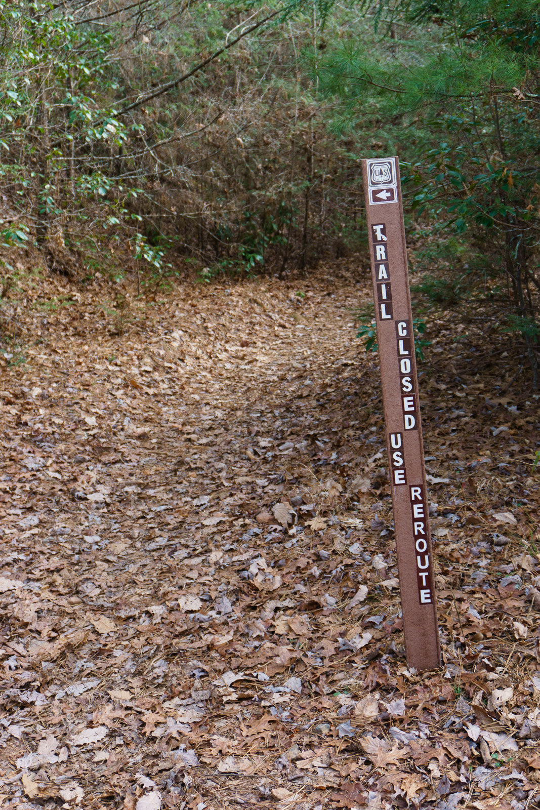
So the trail now turns sharply left, and begins a steeper descent on what used to be Wash Creek Trail. The downhill is short, only going as far as the old road bed Wash Creek Trail follows, and it enters the clearing again. Unfortunately, this stretch is too steep and is already eroding. Hopefully with some sustained heavy maintenance, it can be kept in check.
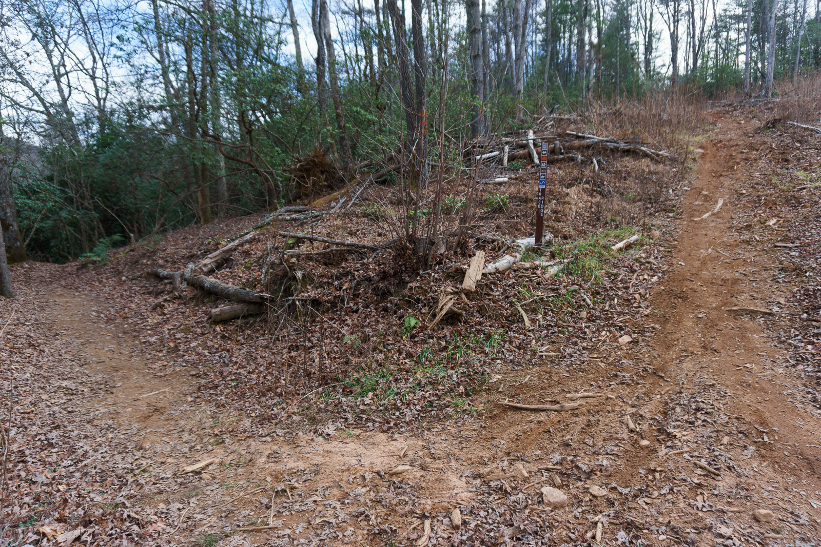
At the bottom of the hill, the Trace Ridge Trail now turns right onto the newly built segment. This new stretch of trail was a long time in the making, but it was done carefully. Using the latest in sustainable trailbuilding techniques, and a combination of hand work and machine grading, the trail already blends in well with the landscape as it winds through mostly short trees, tall rhododendron, and twisted mountain laurels. Some portions look like they could’ve been there for decades already.
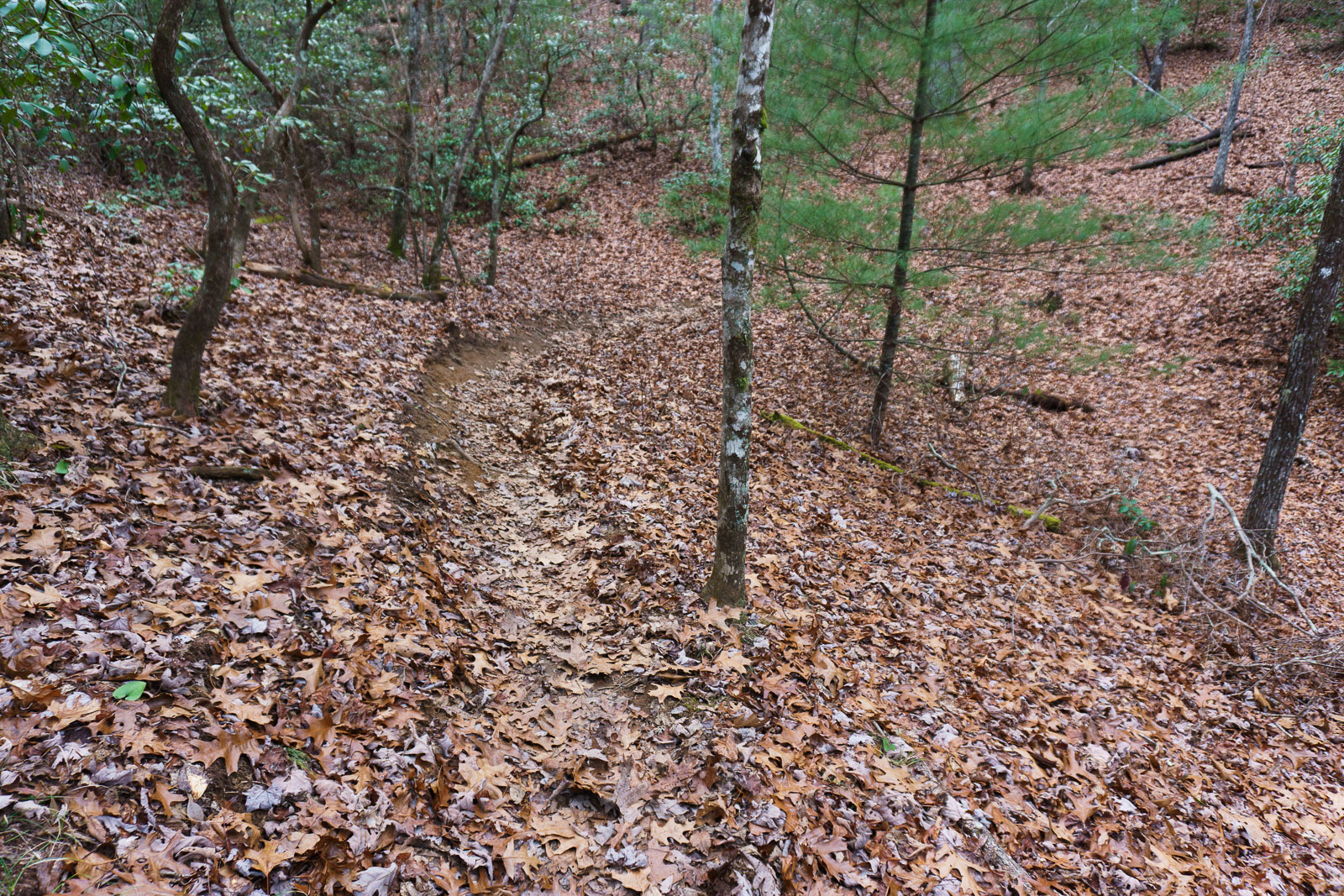
The trail is not far up the slope from the creek, and although it is a descent overall, it is never steep. It only goes uphill for very short stretches to reverse the grade and get the water off. Otherwise, it is a nice hike with only a couple of spots hosting any rocks or mud. The muddy areas might need some touch-up work as time goes on to keep them in check, but otherwise it looks like this trail can be easily maintained over the long haul – not something that could be said of the route the trail originally followed.
Plus, it has a few fun features for mountain bikers to enjoy – some banked turns, grade dips, and patches of rocks. Nothing like the technical old route, but enough to keep it from becoming boring. Nice work! I only wish I’d had more time to come out and contribute to the project while it was ongoing.
In no time, the trail reaches the river bottom, where there is a clearing and the junction with North Mills River trail next to a huge oak tree.
To the right at the junction, you can see the bottom of the old Trace Ridge Trail, and why it was re-routed. The erosion on that last stretch of trail was considerable.
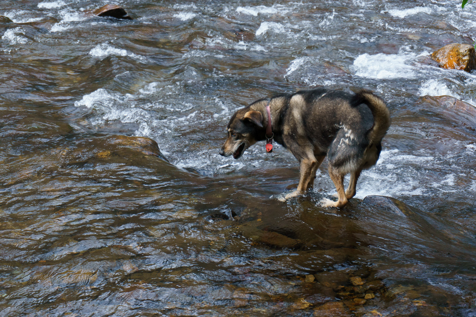
We had some more time to explore, but unfortunately there’s not many places you can go down here on foot – unless you’re ready to get really wet. Despite the warm December day on which we were hiking, that wasn’t really in the plan so we just did what we could.
First, we went left down to the river. The trail almost immediately crosses it, so we stopped and just watched the water flow for a bit. On the other side, the trail makes its way through what is currently a chunk of private property down to FS 1206 just west of the N. Mills River Campground and Recreation Area.
Unfortunately, that stretch of trail was closed when the property, which is completely surrounded by National Forest land, changed owners in the mid-2000’s. The new owner, who was a developer, had planned on building a large residential project in this “hole” in the National Forest, but Henderson County shot down those plans. Thankfully.
Last I heard, the property owner had ended up placing a conservation easement on most of the land, including the trail, and conservation organizations were waiting on funding to complete a purchase of the property outright. When and if that happens, perhaps that will open up some more possibilities for hiking and riding in this area. Until then, don’t trespass. We turned around.
Next, we headed upstream on the North Mills River trail through the clearing to its next crossing. This one has a bridge, however. A small path leads right just before the ford to a neat suspension bridge which will let you keep your feet dry.
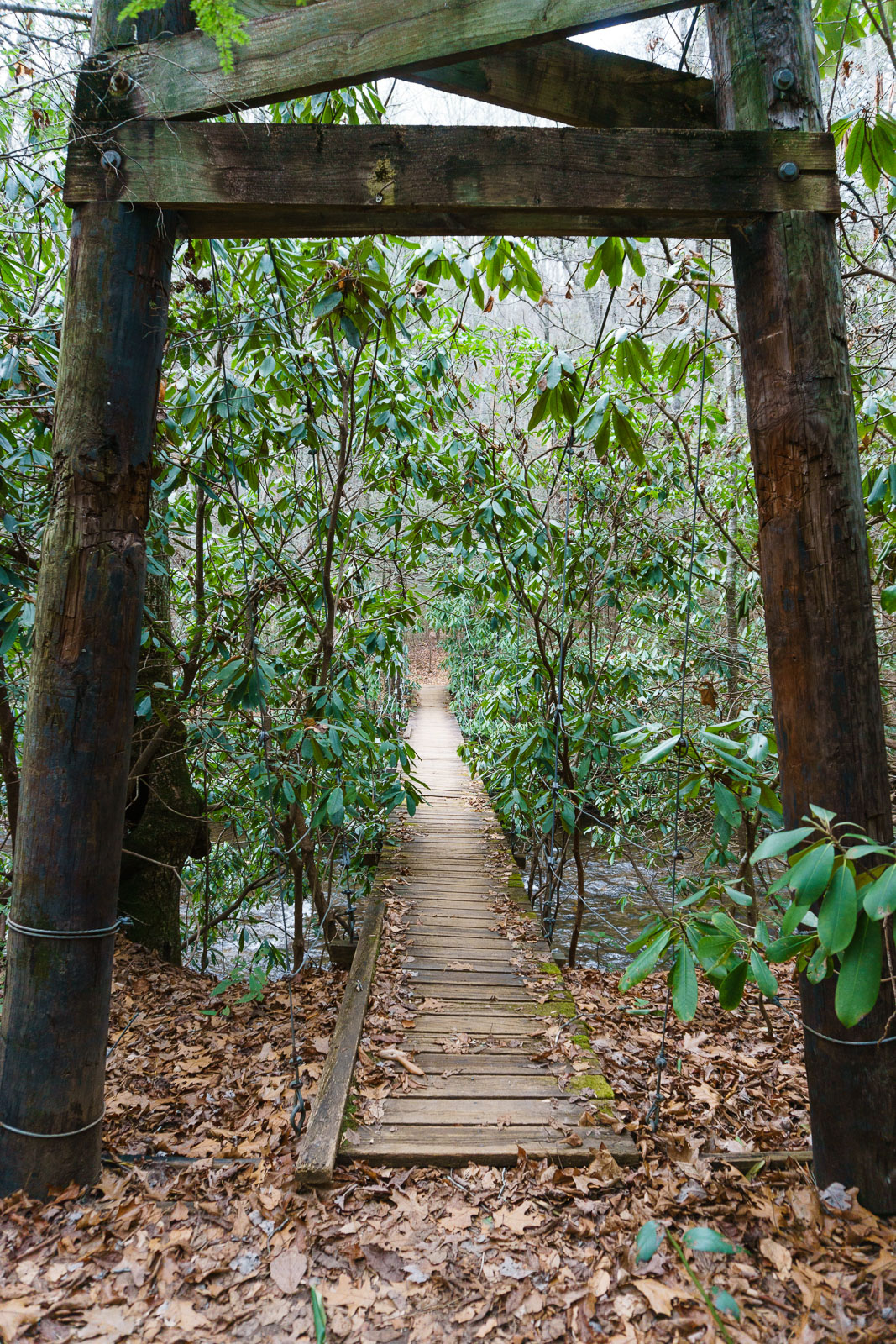
It’s been a long time since I crossed this bridge, because it’s kind of a “bridge to nowhere”. The only thing it allows you to access is a short stretch of trail on the other side of the river, which does have a nice campsite area. But other than that, nothing. There are no trail junctions from which to form loops or extended trips upriver without fording it multiple times. There are two of these fords before the next trail junction (Yellow Gap Trail), and half a dozen before the trail ends on Hendersonville Reservoir Road. It’s a beautiful, but wet, slog.
Hopefully, in the future, a connector can be made to the stretch of trail that is now on private property just downstream on the other side of the bridge, and a couple of the loops of river that the trail now fords could be bypassed. That could bring the number of wet crossings down to a manageable one (1), and with another bridge a that crossing you could even stay dry the entire way up to Hendersonville Reservoir Road, while accessing Yellow Gap Trail and the trail to the N. Mills River Recreation Area. That would really open up the possibilities for cold-weather trips in this area.
Until then, bring spare dry gear, some sturdy hiking poles (or a bike) for stability on the slippery rocks, and prepare to get soaked – or just do what we did and turn around at the first ford.
From there, we ambled back across the bridge, through the clearing, and back up the Trace Ridge Trail to the parking area making for an uneventful yet pleasant short hike. I did stop to take some more photos in the logged area and get a better sense of what impacts logging has on recreation in the National Forests.
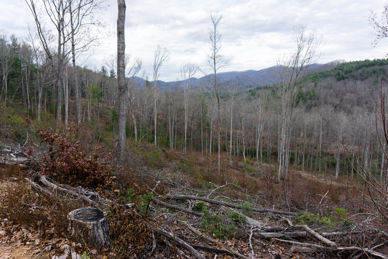
While logging doesn’t preclude the opportunity for recreation in the area, the clearings are somewhat unsightly until they start growing back, but that happens quickly. Rather than clearcutting, modern Forest Service harvests like this one tend to leave some trees remaining to provide seed stock for the next generation of trees, which also serves to greatly lessen their visual impact. But the clearings can still get really hot in the summer for recreational users since the sun now pours in.
New road building is probably the worst impact from contemporary logging projects, as it can silt streams, sever trails, prompt landslides on steep slopes, and remain visible far longer than the cleared areas do as it more or less permanently alters the landscape.
Ultimately, the impact on recreation from logging (especially mountain biking) in nondescript parts of the forest like this is not a deal-breaker, and projects like this one illustrate that it can be done responsibly. No new roads were built – only existing ones were re-opened. Waterways like Wash Creek were buffered from cutting and remained pristine (visually at least). And the trees are growing back, even more vigorously than before, providing open areas for wildlife and a yield of sustainable timber products to boot. It’s not all bad.
But this area isn’t Laurel Mountain, Cedar Rock, or Harper Creek, either. It’s not Big Ivy, with its vast acreage of old-growth forest and extraordinary biological status. It’s not a rare high-elevation valley filled with bogs and rimmed with cliffs on all sides like Panthertown. As far as I’m concerned, I’m okay with responsible logging projects in places like North Mills River if they can leave the truly incomparable areas elsewhere alone. And I’m hoping that makes it into the new forest plan which will be in force for a long time to come when it’s done.
I’m glad I was able to check out the lower Trace Ridge Trail re-route and logging project aftermath, but without some improved connections I imagine I won’t be doing this trail again until I’m ready to get really wet!
[map style=”width: 100%; height: 400px;” gpx=”/wp-content/uploads/2015/12/2015-12-13-Lower-Trace-Ridge-Reroute.gpx”]
Leave a Reply