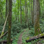
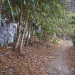
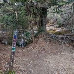
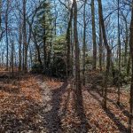
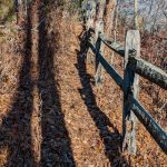
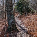
Yellow blazes mark the path of the Hickey Fork Trail.
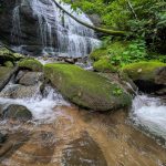
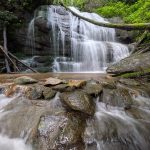
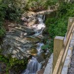
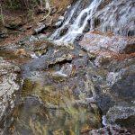
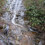
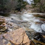
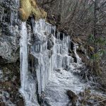
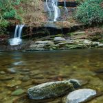
Waterfall on West Prong Hickey Fork
Waterfall on West Prong Hickey Fork
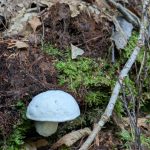
Mushroom growing along the Hickey Fork trail.
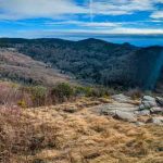
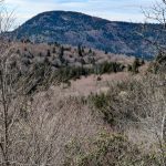
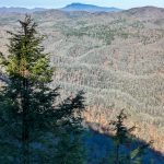
Below the waterfall on West Prong Hickey Fork, the trail offers several views out over the valley bottom like this one.
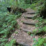
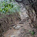
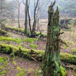
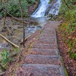
Beautifully constructed log steps along the Hickey Fork trail.
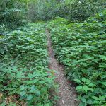
Stinging nettle lines the Hickey Fork trail in places. Best to hike this one with long pants!
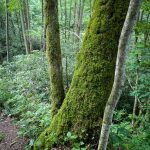
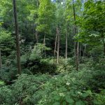
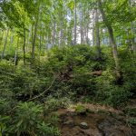
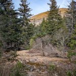
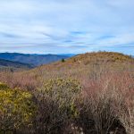
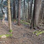
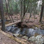
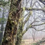
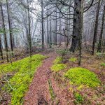
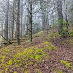
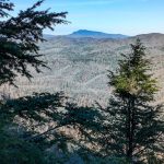
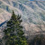
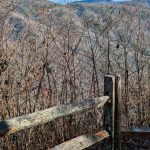
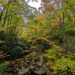
A typical stream bottom in the Shelton Laurel area, thick with rhododendron and beneath towering white pines and hardwood trees.
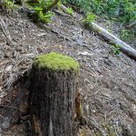
A once-sizable dead hemlock tree looms over the Hickey Fork Creek valley in the Shelton Laurel area of Pisgah National Forest.
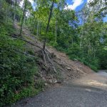
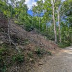
This landslide came down across the Catawba Falls trail during Hurricane Helene. Fortunately, damage to the trail hear appears to be minimal. There are several such landslide scars along this trail.
This landslide came down across the Catawba Falls trail during Hurricane Helene. Fortunately, damage to the trail hear appears to be minimal. There are several such landslide scars along this trail.
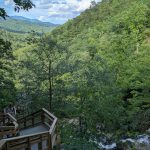
View from the staircase ascending Catawba Falls, above the big tower structure.
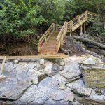
Flooding from Hurricane Helene put a stop to construction on this viewing platform planned for the upper Catawba Falls area.
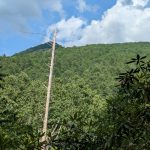
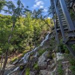
A massive steel tower lets visitors climb safely hundreds of feet alongside the falls.
A new overlook above the Lower Falls provides a good view directly from the trail as of early 2025.
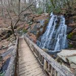
A small waterfall is beside the Flat Laurel Creek trail, very near its junction with NC Hwy 215. This is sometimes mislabeled as Wildcat Falls, which is actually about 0.4 mi further along the trail, at the concrete bridge.
This unique, out-of-place-looking concrete bridge spans Wildcat Falls on the Flat Laurel Creek trail, which is an old railroad grade.
Wildcat Falls, which flows under a unique concrete bridge on the Flat Laurel Creek trail.
Icecicles line the rock cut face along Flat Laurel Creek trail, which is a former railroad grade along much of its current path.
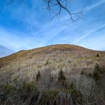
View of Sam Knob from Flat Laurel Creek Trail
Sam Knob rises behind the spruce-fir forest lining Flat Laurel Creek.
Flat Laurel Creek at the Sam Knob Trail crossing
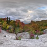
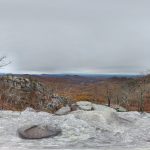
West view panorama from Sam Knob.
View of the north summit of Sam Knob from the south summit.
Steps ascending through a rhododendron thicket on the Sam Knob trail.
Start of the Sam Knob trail at the Flat Laurel Creek trail junction. The trail crosses the creek and climbs the steps just beyond.
Icecicles line the rock cut face along Little Sam Trail, which is a former railroad grade along much of its current path.
View of Mount Hardy from the Little Sam trail.
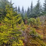
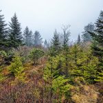
Red Spruce dominate the forest landscape on the Mountains to Sea Trail just east of NC Hwy 215.
The Mountains to Sea Trail crosses this bridge over a tributary of Bubbling Spring Branch not far from NC 215, in a peaceful Spruce-Fir forest.
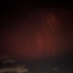
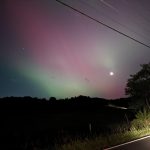
The Aurora Borealis visible above the Swannanoa Mountains along the Blue Ridge Parkway, during the geomagnetic storm of May 10, 2024.
The Aurora Borealis visible above the Swannanoa Mountains along the Blue Ridge Parkway, during the geomagnetic storm of May 10, 2024.
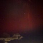
The Aurora Borealis visible above Shope Creek Valley on the Blue Ridge Parkway, during the geomagnetic storm of May 10, 2024.
The Aurora Borealis visible above Shope Creek Valley on the Blue Ridge Parkway, during the geomagnetic storm of May 10, 2024.
The Aurora Borealis visible above Shope Creek Valley on the Blue Ridge Parkway, during the geomagnetic storm of May 10, 2024.
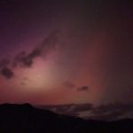
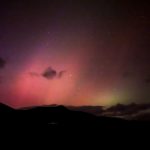
The Aurora Borealis visible above Lane Pinnacle on the Blue Ridge Parkway, during the geomagnetic storm of May 10, 2024.
The Aurora Borealis visible above Lane Pinnacle on the Blue Ridge Parkway, during the geomagnetic storm of May 10, 2024.
The Aurora Borealis visible above Lane Pinnacle on the Blue Ridge Parkway, during the geomagnetic storm of May 10, 2024.
The Aurora Borealis visible above the fields at Warren Wilson College, during the geomagnetic storm of May 10, 2024.
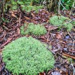
Pillow-shaped mounds of lichen grow on the ground near Mount Hardy
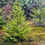
Christmas-tree shaped Red Spruce grow on the side of Mount Hardy
Glade on the side of Mount Hardy
The summit of 6110 ft Mount Hardy is a broad, nearly flat dome covered in a dense spruce-fir forest.
Mossy trees growing on Mount Hardy
Young Red Spruce trees grow around a mossy glade on Mount Hardy
Glade on the side of Mount Hardy
Trail to Mount Hardy Summit
Spruce-Fir Forest on the North Slopes of Mount Hardy on the Mountains to Sea Trail
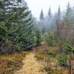
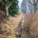
Narrow Section of the Mountains to Sea Trail in Middle Prong Wilderness
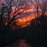
Sunset over Deep Creek at the Tom Branch Road bridge.
Tom Branch Falls drops directly into Deep Creek, not far from the picnic area. This is a popular spot for swimming and tubing in the warmer months!
Foot bridge over Juney Whank Falls, near Deep Creek.
Steps leading down to the viewing area of Indian Creek Falls.
Steps down to the first main overlook on the Chestoa View Trail
At the start of the Chestoa View trail is the main overlook with this view Grandfather Mountain.
At the start of the Chestoa View trail is the main overlook with this view Grandfather Mountain.
At the start of the Chestoa View trail is the main overlook with this view of Table Rock across the Linville Gorge.
A flat stretch of the easy, short loop Chestoa View Trail.
Wood fence along the Chestoa View Trail protects visitors from the steep cliffs overlooking the North Fork Catawba River valley.
View of Table Rock across the Linville Gorge from the Chestoa View Trail overlook.
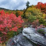
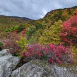
Chestoa View Trail in Autumn
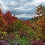
Panoramic view from Storyteller’s Rock at the end of the Nuwati Trail in early fall.
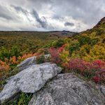
View from Eagle Rock on a Late Autumn Gray Day. Some nice fall color still persists in the lower elevations of the Blue Ridge escarpment into mid-November.
View of the ridge behind Storyteller’s Rock at the end of the Nuwati trail.
At the end of the Nuwati trail is Storyteller’s Rock, and this view up to Calloway Peak in early fall.
At the end of the Nuwati trail is Storyteller’s Rock, and this view up to Calloway Peak in early fall.
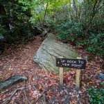
“Up Rock to View Point”. Okay!
View east toward the Piedmont from Storyteller’s Rock at the end of the Nuwati trail in early fall.
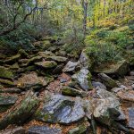
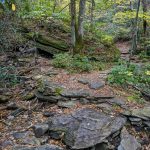
The upper reaches of Boone Fork are choked with boulders where the Nuwati trail crosses on its way up to Storyteller’s Rock and The Refuge (campsite).
Nuwati Trail swings right across the double upper feeders of Boone Fork at this giant sloping boulder.
Crossing of a small side stream feeding into Boone Fork on the Nuwati trail.
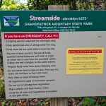
Sign for the Streamside campsite on the Nuwati trail in Grandfather Mountain State Park.
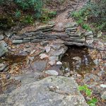
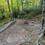
The Streamside campsite on the Nuwati trail in Grandfather Mountain State Park.
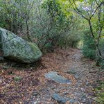
Big Boulder beside the Nuwati Trail in Grandfather Mountain State Park.
Junction of the Tanawha and Nuwata trails at the edge of Grandfather Mountain State Park and the Blue Ridge Parkway.
Boone Fork as seen from the Tanawha Trail near the Boone Fork Parking Area on the Blue Ridge Parkway.
View of Grandfather Mountain’s McRae Peak peeking out from behind the clouds on the Blue Ridge Parkway just north of Linn Cove Viaduct, at the Yonahlossee Overlook.
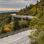
Early Fall view of the Linn Cove Viaduct, with Table Rock and Hawksbill Mountain in the distance along Linville Gorge.
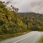
View of Pilot Mountain (right) and Hanging Rock (left) on the horizon from near the Cumberland Knob recreation area.
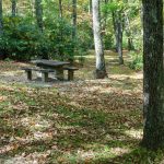
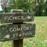
The picnic area at Cumberland Knob has a modern side in the meadow to the left of this photo, and an older rustic side nestled in the woods, seen here.
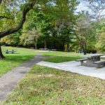
The picnic area at Cumberland Knob has a modern side, seen here, and an older rustic side to the right of this photo.
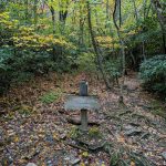
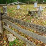
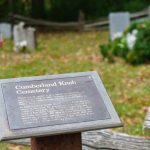
Fence and the Cumberland Knob Cemetery
There are 19 graves in this small family cemetery from 1908 to 1960. Among those buried here are four infants and sixteen year old Rebecaca Smith Moxley.
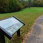
Cumberland Knob trail in the meadow adjacent to the picnic area.
Moss and lichen grow on these classic carved wood signs on the Blue Ridge Parkway at Cumberland Knob.
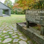
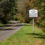
Sign for the Cumberland Knob recreation area on the Blue Ridge Parkway.
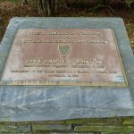
The Blue Ridge Parkway displays some of its awards and recognition in Cumberland Knob Park, just south of the NC/VA State Line.
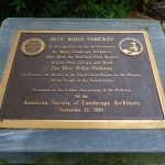
Plaque recognizing the achievements of the landscape architects who helped plan, design, and build the Blue Ridge Parkway.
BLUE RIDGE PARKWAY – First rural national parkway. Construction began near here on September 11, 1935.
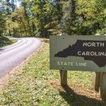
NC/VA State Line on the Blue Ridge Parkway
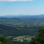
Aerial view of Asheville, NC in the waning days of summer.
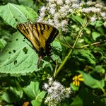
Swallowtail butterfly on wildflowers growing beside the Old Mitchell Toll Road.
Red Spruce grow beside the Old Mitchell Toll Road near the Blue Ridge Parkway.
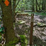
Blue Ridge Pinnacle trail where it joins the Old Mitchell Toll Road.
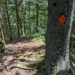
Orange blaze along the Blue Ridge Pinnacle trail near the Old Mitchell Toll Road
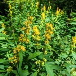
Yellow wildflowers growing beaide the Blue Ridge Pinnacle Trail.
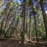
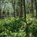
An open forest filled with sedges and ferns on the Blue Ridge Pinnacle trail between the summit and Old Mitchell Toll Road.