-
-
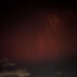
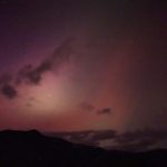
The Aurora Borealis visible above the Swannanoa Mountains along the Blue Ridge Parkway, during the geomagnetic storm of May 10, 2024.
-
-
The Aurora Borealis visible above the Swannanoa Mountains along the Blue Ridge Parkway, during the geomagnetic storm of May 10, 2024.
-
-
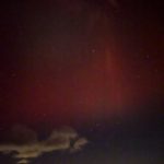
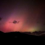
The Aurora Borealis visible above Shope Creek Valley on the Blue Ridge Parkway, during the geomagnetic storm of May 10, 2024.
-

-
The Aurora Borealis visible above Shope Creek Valley on the Blue Ridge Parkway, during the geomagnetic storm of May 10, 2024.
-

-
The Aurora Borealis visible above Shope Creek Valley on the Blue Ridge Parkway, during the geomagnetic storm of May 10, 2024.
-
-
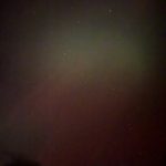
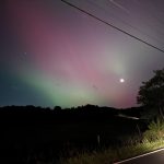
The Aurora Borealis visible above Lane Pinnacle on the Blue Ridge Parkway, during the geomagnetic storm of May 10, 2024.
-
-
The Aurora Borealis visible above Lane Pinnacle on the Blue Ridge Parkway, during the geomagnetic storm of May 10, 2024.
-
-
The Aurora Borealis visible above Lane Pinnacle on the Blue Ridge Parkway, during the geomagnetic storm of May 10, 2024.
-
-
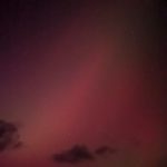
The Aurora Borealis visible above the fields at Warren Wilson College, during the geomagnetic storm of May 10, 2024.
-
-
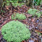
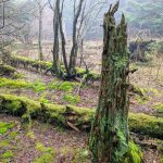
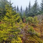
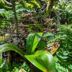
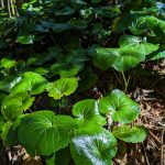
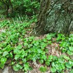
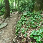
Pillow-shaped mounds of lichen grow on the ground near Mount Hardy
-
-
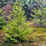
Christmas-tree shaped Red Spruce grow on the side of Mount Hardy
-
-
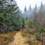
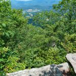
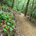
Glade on the side of Mount Hardy
-
-
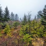
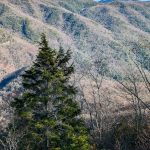
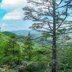
The summit of 6110 ft Mount Hardy is a broad, nearly flat dome covered in a dense spruce-fir forest.
-
-
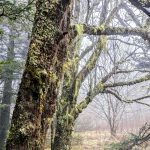
Mossy trees growing on Mount Hardy
-
-
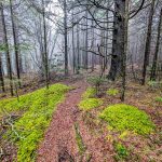
Young Red Spruce trees grow around a mossy glade on Mount Hardy
-
-
Glade on the side of Mount Hardy
-
-
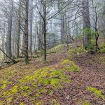
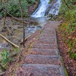
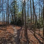
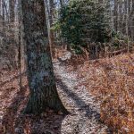
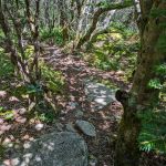
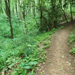
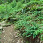
Trail to Mount Hardy Summit
-
-
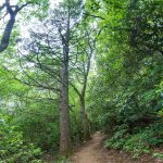
Spruce-Fir Forest on the North Slopes of Mount Hardy on the Mountains to Sea Trail
-
-
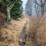
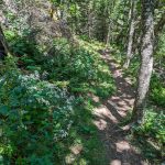
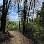
Narrow Section of the Mountains to Sea Trail in Middle Prong Wilderness
-
-
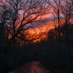
Sunset over Deep Creek at the Tom Branch Road bridge.
-
-
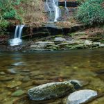
Tom Branch Falls drops directly into Deep Creek, not far from the picnic area. This is a popular spot for swimming and tubing in the warmer months!
-
-
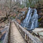
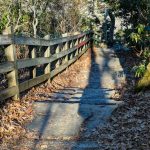
Foot bridge over Juney Whank Falls, near Deep Creek.
-
-
Steps leading down to the viewing area of Indian Creek Falls.
-
-
Steps down to the first main overlook on the Chestoa View Trail
-
-
At the start of the Chestoa View trail is the main overlook with this view Grandfather Mountain.
-
-
At the start of the Chestoa View trail is the main overlook with this view Grandfather Mountain.
-
-
At the start of the Chestoa View trail is the main overlook with this view of Table Rock across the Linville Gorge.
-
-
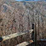
A flat stretch of the easy, short loop Chestoa View Trail.
-
-
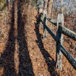
Wood fence along the Chestoa View Trail protects visitors from the steep cliffs overlooking the North Fork Catawba River valley.
-
-
View of Table Rock across the Linville Gorge from the Chestoa View Trail overlook.
-
-
Chestoa View Trail in Autumn
-
-
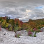
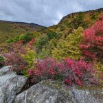
Panoramic view from Storyteller’s Rock at the end of the Nuwati Trail in early fall.
-
-
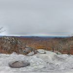
View from Eagle Rock on a Late Autumn Gray Day. Some nice fall color still persists in the lower elevations of the Blue Ridge escarpment into mid-November.
-
-
View of the ridge behind Storyteller’s Rock at the end of the Nuwati trail.
-
-
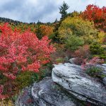
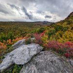
At the end of the Nuwati trail is Storyteller’s Rock, and this view up to Calloway Peak in early fall.
-
-
At the end of the Nuwati trail is Storyteller’s Rock, and this view up to Calloway Peak in early fall.
-
-
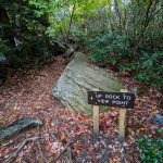
“Up Rock to View Point”. Okay!
-
-
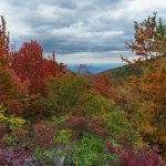
View east toward the Piedmont from Storyteller’s Rock at the end of the Nuwati trail in early fall.
-
-
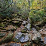
The upper reaches of Boone Fork are choked with boulders where the Nuwati trail crosses on its way up to Storyteller’s Rock and The Refuge (campsite).
-
-
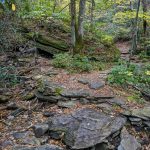
Nuwati Trail swings right across the double upper feeders of Boone Fork at this giant sloping boulder.
-
-
Crossing of a small side stream feeding into Boone Fork on the Nuwati trail.
-
-
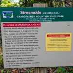
Sign for the Streamside campsite on the Nuwati trail in Grandfather Mountain State Park.
-
-
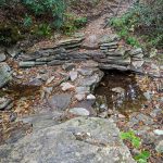
The Streamside campsite on the Nuwati trail in Grandfather Mountain State Park.
-
-
Big Boulder beside the Nuwati Trail in Grandfather Mountain State Park.
-
-
Junction of the Tanawha and Nuwata trails at the edge of Grandfather Mountain State Park and the Blue Ridge Parkway.
-
-
Boone Fork as seen from the Tanawha Trail near the Boone Fork Parking Area on the Blue Ridge Parkway.
-
-
View of Grandfather Mountain’s McRae Peak peeking out from behind the clouds on the Blue Ridge Parkway just north of Linn Cove Viaduct, at the Yonahlossee Overlook.
-
-
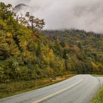
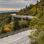
Early Fall view of the Linn Cove Viaduct, with Table Rock and Hawksbill Mountain in the distance along Linville Gorge.
-
-
View of Pilot Mountain (right) and Hanging Rock (left) on the horizon from near the Cumberland Knob recreation area.
-
-
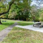
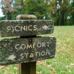
The picnic area at Cumberland Knob has a modern side in the meadow to the left of this photo, and an older rustic side nestled in the woods, seen here.
-
-
The picnic area at Cumberland Knob has a modern side, seen here, and an older rustic side to the right of this photo.
-
-
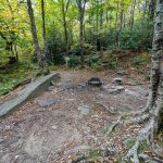
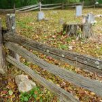
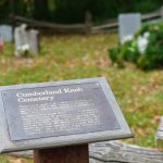
Fence and the Cumberland Knob Cemetery
-
-
There are 19 graves in this small family cemetery from 1908 to 1960. Among those buried here are four infants and sixteen year old Rebecaca Smith Moxley.
-
-
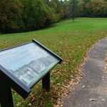
Cumberland Knob trail in the meadow adjacent to the picnic area.
-
-
Moss and lichen grow on these classic carved wood signs on the Blue Ridge Parkway at Cumberland Knob.
-
-
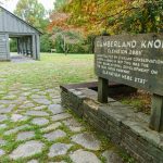
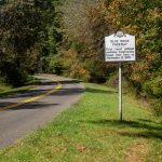
Sign for the Cumberland Knob recreation area on the Blue Ridge Parkway.
-
-
The Blue Ridge Parkway displays some of its awards and recognition in Cumberland Knob Park, just south of the NC/VA State Line.
-
-
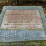
Plaque recognizing the achievements of the landscape architects who helped plan, design, and build the Blue Ridge Parkway.
-
-
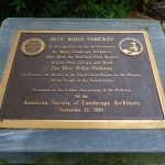
BLUE RIDGE PARKWAY – First rural national parkway. Construction began near here on September 11, 1935.
-
-
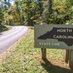
NC/VA State Line on the Blue Ridge Parkway
-

-
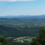
Aerial view of Asheville, NC in the waning days of summer.
-
-
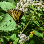
Swallowtail butterfly on wildflowers growing beside the Old Mitchell Toll Road.
-
-
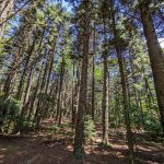
Red Spruce grow beside the Old Mitchell Toll Road near the Blue Ridge Parkway.
-
-
Blue Ridge Pinnacle trail where it joins the Old Mitchell Toll Road.
-
-
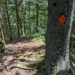
Orange blaze along the Blue Ridge Pinnacle trail near the Old Mitchell Toll Road
-
-
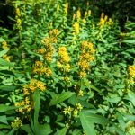
Yellow wildflowers growing beaide the Blue Ridge Pinnacle Trail.
-
-
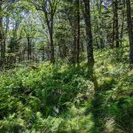
An open forest filled with sedges and ferns on the Blue Ridge Pinnacle trail between the summit and Old Mitchell Toll Road.
-
-
Wildflowers grow in later summer along the Pinnacle trail between the summit and the Old Mitchell Toll Road.
-
-
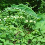
Blue Bead Lily beside the Pinnacle trail.
-
-
Twisted trees on the trail to Blue Ridge Pinnacle.
-
-
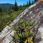
Rhododendrong grows from a narrow crack in the rocks at the summit of Blue Ridge Pinnacle.
-
-
Galax on the Pinnacle Trail
-
-
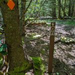
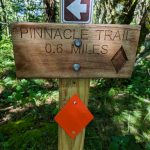
Sign for the Pinnacle Trail, referring to Blue Ridge Pinnacle and not to be confused with Craggy Pinnacle 9 miles South on the Blue Ridge Parkway.
-
-
-
-
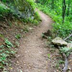
A gentle curve near the 3200 ft elevation on the Strawberry Gap trail.
-
-
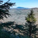
View from Ferguson Peak on the Strawberry Gap Trail. The cliff-top overlook is surrounded by increasingly rare Carolina Hemlock trees.
-
-
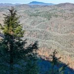
The first view you encounter on top of Ferguson Peak on the Strawberry Gap tril.
-
-
Galax surrounds the base of a tree on the Strawberry Gap trail.
-
-
Carolina Hemlock is an increasingly rare species which can still be found along the Strawberry Gap trail, for now (as of 2023).
-
-
Galax blooms along the Strawberry Gap trail.
-
-
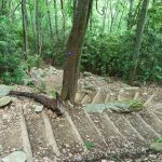
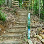
S-shaped stairs along a steeper part of the Strawberry Gap trail.
-
-
Galax grows along the Strawberry Gap Trail.
-
-
Ferns along the Strawberry Gap Trail.
-
-
Solomon’s Seal blooms along the Strawberry Gap trail in early June.
-
-
Rock outcrop along the Strawberry Gap trail.
-
-
Steps and fence on the Strawberry Gap trail at a junction with a private trail. Stay on the marked Strawberry Gap trail.
-
-
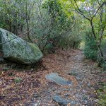
Private trails lead away from Strawberry Gap Trail. Be sure to stay on the marked trail. It is well signed and easy to follow.
-
-
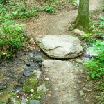
Strawberry Gap Trail has just one creek crossing, right at the beginning, an easy one via these stepping stones.
-
-
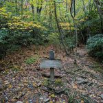
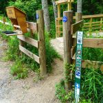
Register, fence, and sign at the start of the Strawberry Gap trail.
-

-
Memorial for Susie Skinner Clarke Hamilton at the start of the Strawberry Gap Trail.
-
-
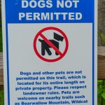
No dogs are allowed on the Strawberry Gap Trail. Not even the little tiny ones.
-
-
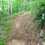
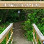
Entrance to the Strawberry Gap Trail.
-
-
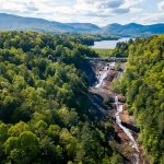
The majority of Toxaway Falls, with the US Hwy 64 road bridge, dam, Toxaway Lake, and Toxaway Mountain all upstream.
-
-
The uppermost, highest drop of Toxaway Falls, with the US Hwy 64 road bridge, dam, Toxaway Lake, and Toxaway Mountain all upstream.
-
-
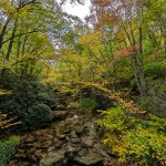
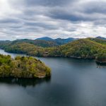
Lake Glenville in spring foliage.
-
-
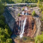
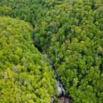
High Falls of the Tuckasegee River sits below Lake Glenville, and is now normaly dewatered except during recreational flow release days, when it roars.
-
-
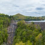
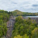
Lake Glenville Dam covers what was once called Onion Falls on the Tuckasegee River. The new, much-larger falls of the dam’s spillway (left) is now sometimes called Onion Falls.
-
-
Lake Glenville Dam covers what was once called Onion Falls on the Tuckasegee River. The new, much-larger falls of the dam’s spillway (left) is now sometimes called Onion Falls.
