
I have been meaning to check out the Carlton’s Way trail on the north side of the Panthertown Valley, a recent addition to the list of official trails in the valley and one I’d not been on yet. It fit the bill for what we were looking for in a family hike – not too difficult, nice views, and potential waterfall visits once we got down into the valley (great for enticing children to keep on hiking!). So with stretches of warm, spring-like weather starting to appear along with the earliest wildflowers, we decided to get out and scope out this trail on a recent family hike.
Our hike started at the Salt Rock parking area at the west end of the valley. After the long, curvy, tortuous drive on US 64 from Brevard through Sapphire Valley, we were all happy to get out of the car and into the fresh air at the trailhead. I found a great hiking stick someone else had left behind and we headed out, up the Blackrock trail, to begin.
This trail has had some work done on it recently and the purpose-built singletrack is in good shape at the beginning. It climbed steadily but not steeply, and wrapped around from a northwesterly to a southeasterly direction as it climbed up the ridge onto an old road bed. The surface from there on is wider and a bit more eroded as it picks up an old road bed, but generally good overall. It remains right on top of the ridge during this entire section.
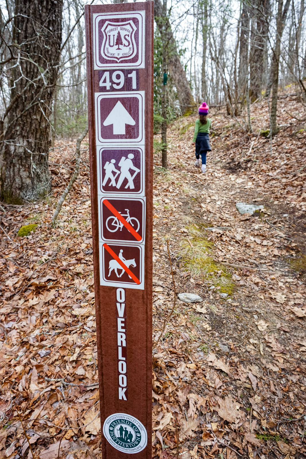
As you approach the summit of Blackrock Mountain, the grade steepens a bit but never becomes excessive. It’s about that time when we started looking for the junction with the Overlook trail, which we found on the right just as expected. That narrower trail made its way the last few feet up to the very summit before starting downhill.
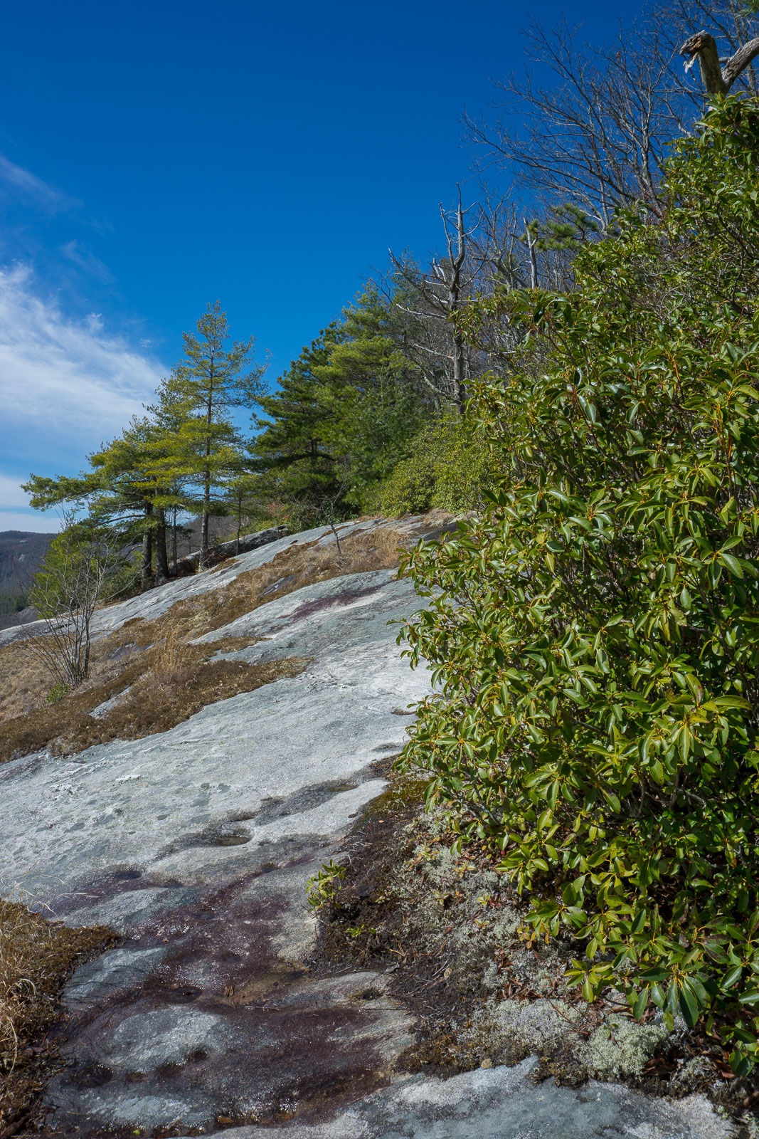
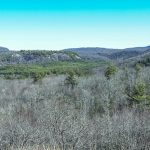
We were all thinking it a bit odd to be heading downhill to the overlook, but that’s just what this trail does when coming from this direction. It’s steep in spots, too. The cliffs that afford the view are a good bit below the summit, but when you arrive there’s no mistaking it. A gorgeous 180-degree view of the Panthertown Valley opens right up between the trees and understory growth of typical rhododendron and mountain laurel. Featuring Big and Little Green Mountains closer by with numerous other peaks rimming the horizon, it’s a truly stunning vista!

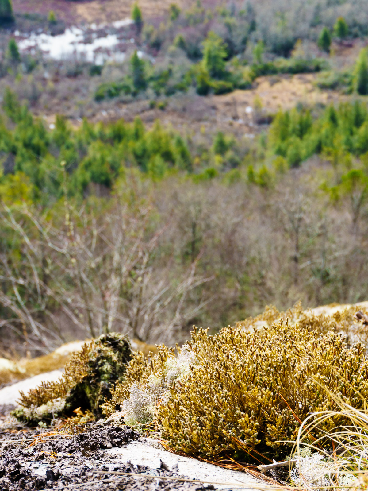
The area along the trail, at the top of the cliffs, had plenty of flat, safe ground to hang out and enjoy the view from. There were some nice, shady pines whispering in the warm breeze, providing relief from the sun – which was blazing through the crystal-clear air we were treated to that day. Just stay back from the edge, which is not hard to do. It’s a perfect spot to enjoy a picnic lunch, too, which is exactly what we did as we watched the hawks soar around the valley, eyeing for their next meal. We could see the wetlands down in the valley, surrounded by the dark green white pines, beyond the overlook rocks encrusted with mosses and lichens.
After a satisfying lunch (some of which my daughter inadvertently shared with local ants!) we packed up and continued the hike. Beyond the overlook, the trail descended through the forest again, somewhat steeply in spots. But we got a good look back up at the overlook cliffs from where it entered the forest. Watch for wet spots on the rock in these lower sections of the overlook area, which could be slick.
Next, we made our way down to the Carlton’s Way trail, the one I’d come to check out. It made a nice connector down to the valley where we wanted to go next, and formed a vital part of our loop hike, but if I’m being honest, it’s pretty unremarkable otherwise. The forest is fairly short on this part of the mountain which is a valley etched along its side, but nothing terribly scenic presented itself. The trail is eroded in spots, and descends through a few switchbacks before arriving at its bottom junction with the North Road trail, where we turned right.
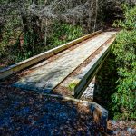
Shortly thereafter, we arrived at this nice new bridge, several of which have been constructed in Panthertown Valley thanks to the recent trails projects that have been brought to completion in the area.
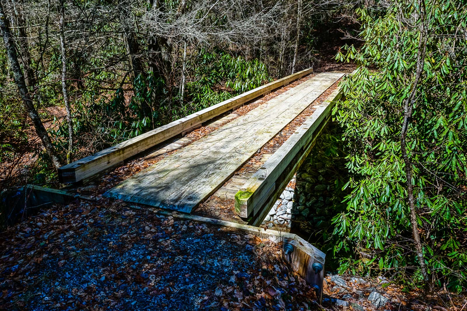
The Forest Service and volunteer groups – namely, Friends of Panthertown – have been doing great work in the area getting the trails up to snuff. The advice for hikers entering Panthertown used to be to treat the area as you would a wilderness, since trails went off in every direction and there were no signs or blazes to mark the way. That’s all changed now, and the trails are nicely signed – if you stick to the named trails, you should have no problem getting around to Panthertown’s main attractions.
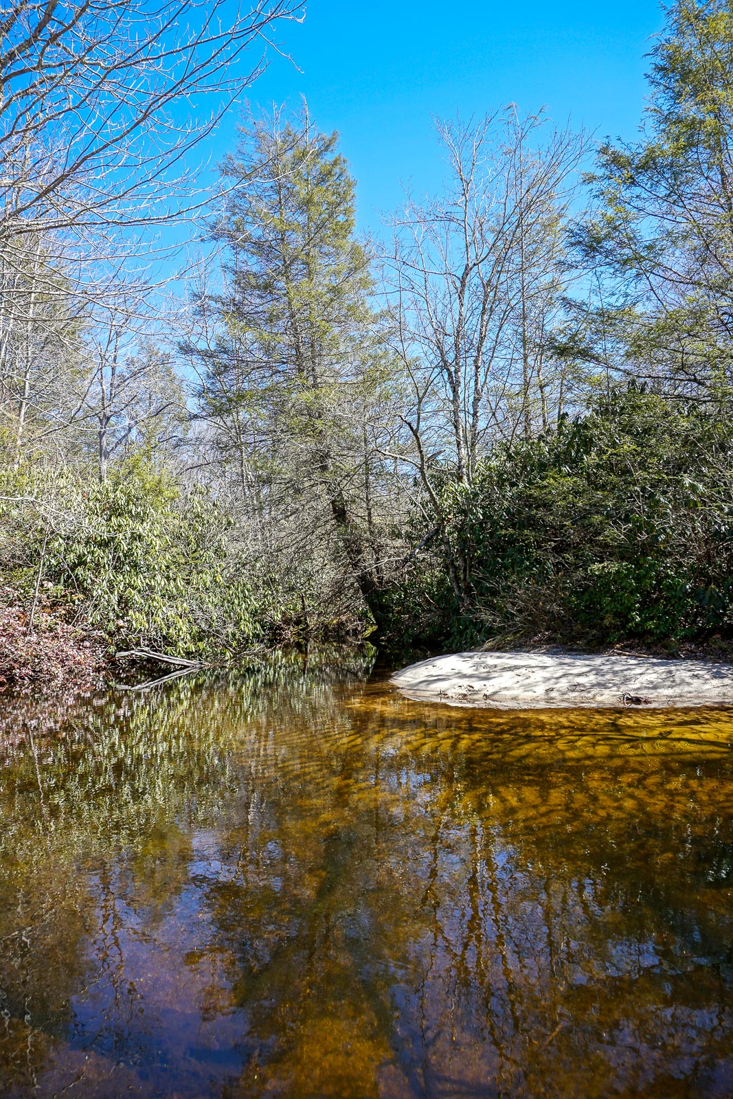
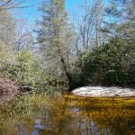
And the next attraction we were headed for was Granny Burrell Falls. We hung a right on Panthertown Valley trail before going left on the Mac’s Gap trail, which winds through stands of Eastern White Pine toward the creek. It crosses the creek on a rickety old bridge that touches the water with its old beams. I’m thinking this one will have to be one of the next to be replaced – it simply doesn’t look like it has much life left in it. But for us that day, it was sturdy enough. We were treated to this scene of the lazy stream just before crossing the bridge, with the tea-colored yet clear stream water lapping at white sand margins.
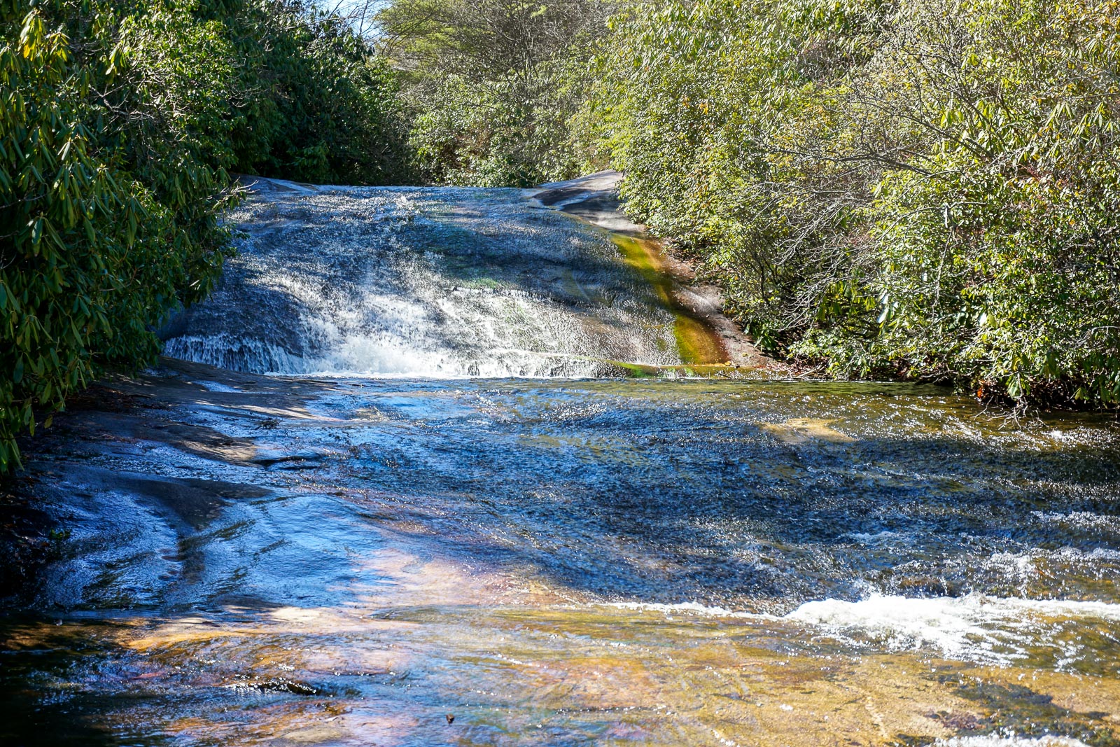
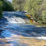
Shortly past the bridge, we hung a right on the Granny Burrell Falls trail. It started out muddy and stayed that way all the way to its end. I’d even say it’s in terrible shape overall, unfortunately. But that’s OK, because it took us to the falls, and that’s where we wanted to go! The photography conditions couldn’t really have been worse, but here’s a shot of the waterfall anyway for posterity.
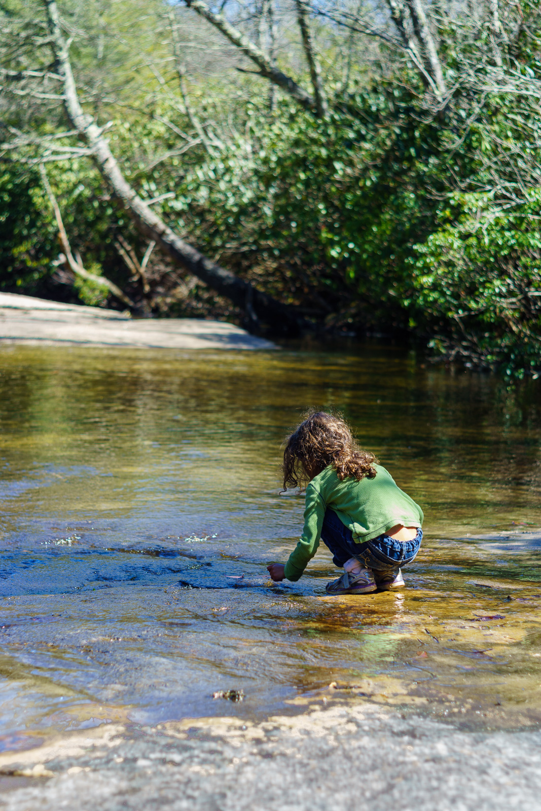
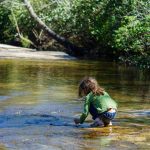
There was more time for soaking up the scenery, and there were more folks out enjoying this part of the trail since we were now closer to the parking area. The little ones even did some playing in the creek. A fantastic spot to hang out and relax!
We climbed up past the falls, arriving at the Great Wall trail, and hung a right. The trail crosses the creek on stepping stones, but they were all submerged this time. So there was no choice but to get some wet feet. I carried my daughter across, thankful for my waterproof boots. Then I realized her shoes were full of water anyway from the Granny Burrell Falls encounter. I should’ve just let her splash through it!
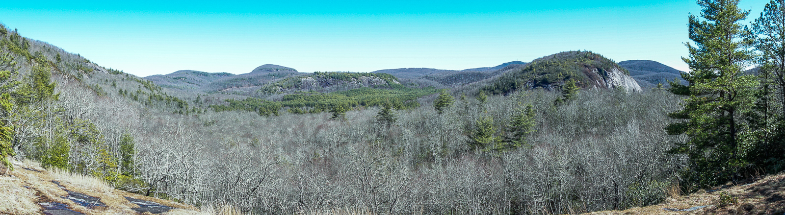
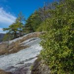
I was hoping to check out the Wilderness Falls trail reroute on the way back, but the little one was pretty tuckered out by this point. So the last part of our hike consisted of the climb up past Salt Rock and back to the parking area. I managed to stop and get one last shot before we tackled the final stretch of trail. Again, it was stunning just how clear the air was this day – something you don’t see too often, especially in the warmer months.
I guess missing the Wilderness Falls trail gives me a great excuses to come back here soon. Which is good, because Panthertown has become one of my favorite places to get out and hike or ride. Below is a map of our hikeHead on over to the Panthertown Valley trailhead page on Hike WNC or MTB WNC for all the details!
[map style=”width: 100%; height: 400px;” gpx=”/wp-content/uploads/2015/03/2015-03-17-Panthertown-Overlook-Loop.gpx”]-
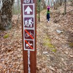
- Sign on the Overlook Trail
-
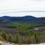
- Blackrock Mountain Overlook
-
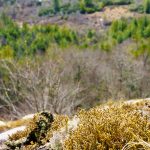
- Lichens on Blackrock Overlook
-
- The Overlook on Blackrock Mountain
-
- New Bridge in Panthertown
-
- Pool on Panthertown Creek
-
- Playing in the Water at Granny Burrell Fals
-
- Granny Burrell Falls
-
- Panoramic View from Salt Rock
Scott Slusser
Just completed the hike you suggested with my wife and son for his second birthday today. It was as good a hike as conditions would permit. The views were stunning and the waterfalls wonderful. We look forward to returning this summer for some camping.