
In a post last week, I shared some small “discoveries” my family and I made while hiking in the Shope Creek section of Pisgah National Forest near the Riceville community east of Asheville. Ever since that hike, I couldn’t stop thinking about going back (with my real camera) and getting some better shots of “Casita Falls” on Wolf Branch, and doing some more exploring. Saturday I got that chance, and with it came some much bigger surprises than the week before.
One of which was the size of a mountain, and really should have come as no surprise at all!
But first, the easy parts. Read on for the adventure.
Since Shope Creek was opened to the public few years ago, I’ve hiked there many times. But for whatever reason, I’ve never really considered it suitable for longer day trips – only for after-work exercise jaunts or short trips with the family. Like the impromptu kind we did last weekend.
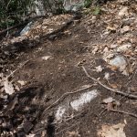
The lack of a designated trail system in the area probably factored in to this, although I’m normally fine with unmarked trails and even off-trail exploration. Perhaps it was all the logging that’s been done in the lower areas, giving me the impression that it just wasn’t as “pretty” as some other sections of the mountains. But ultimately, my only trips into the higher elevations of Shope Creek were a few quick hikes on the same old logging road.
That all changed on Saturday as I really got into the area to explore it more deeply. I took Darla, my peppy shepherd mix dog, with me for companionship since I was hiking alone.
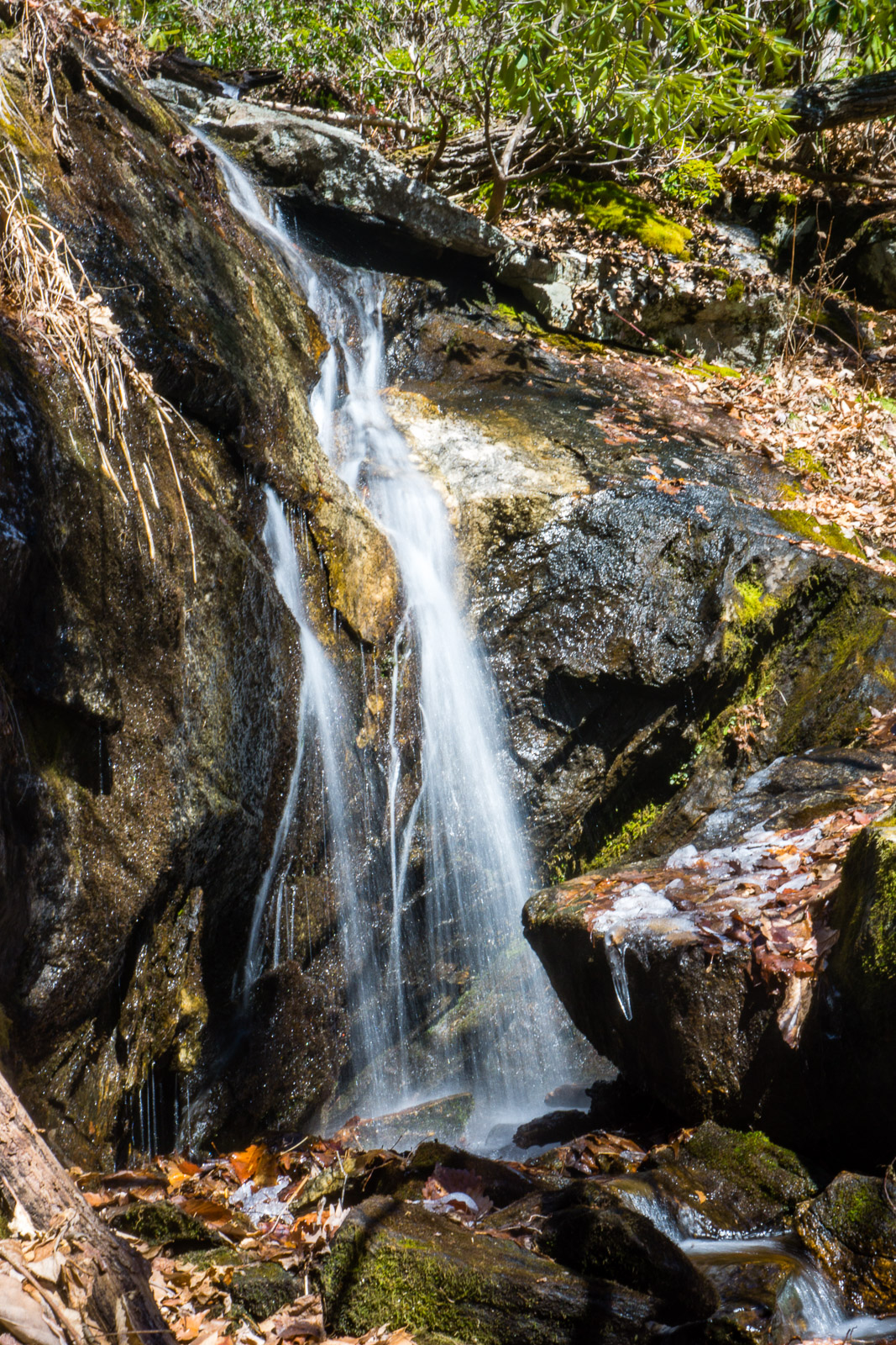
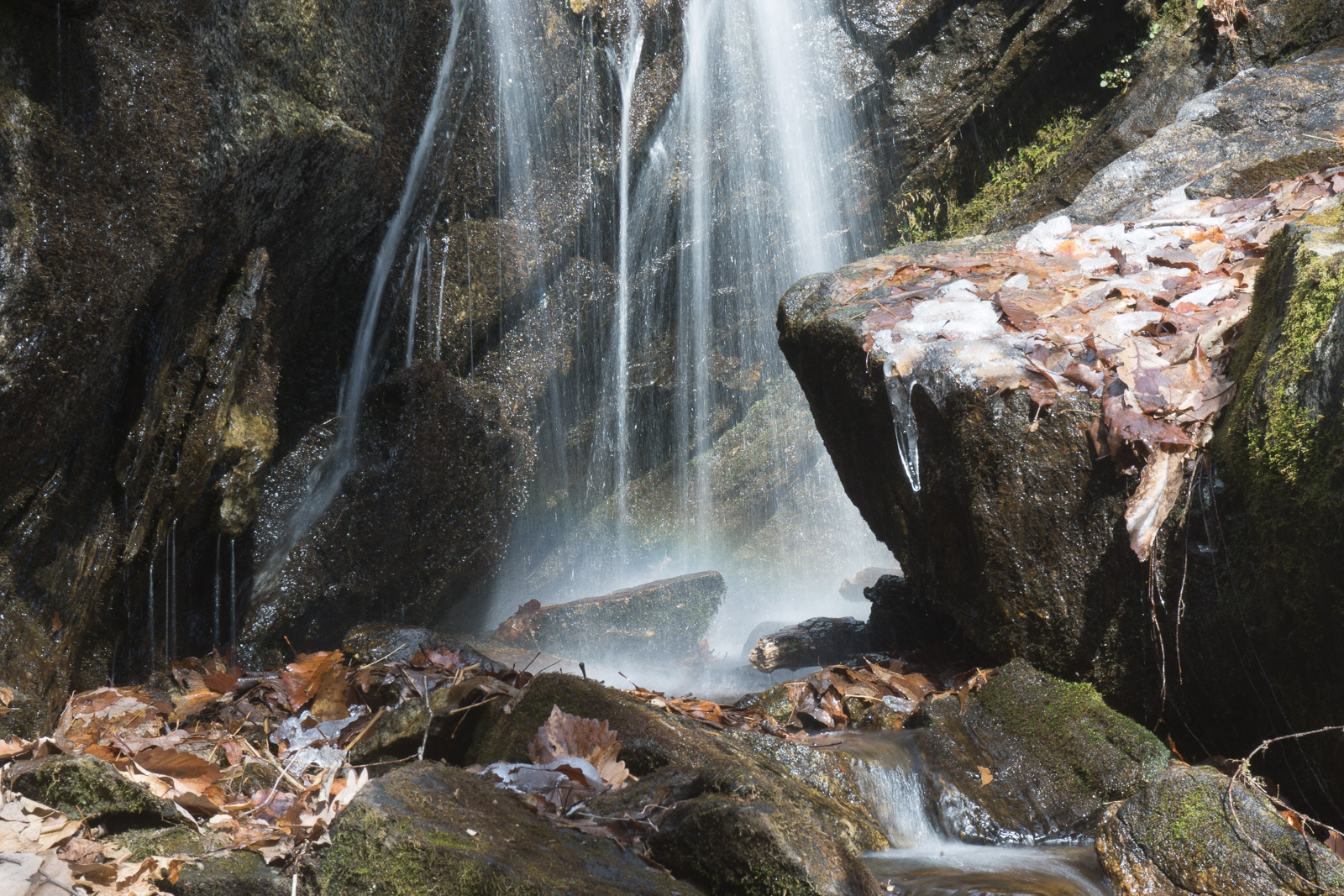
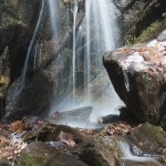
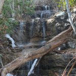
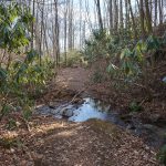
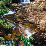
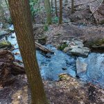
My first stop was the same waterfall the family and I visited last week – the waterfall on Wolf Branch, or Casita Falls, depending on whom you ask. Though the sun was shining brightly once again, I was able to get closer to the top and get a few better photos, such as the one at the top of this post. Here’s another, which shows a little rainbow near the base of the upper drop. Keep in mind that you can’t see this angle from the end of the “trail”, and getting this view requires an unsafe scramble over fragile soils and slick rocks. I had to be extremely careful not to cause any undue impact here, on myself or the environment.
As I returned to the upper part of the logged area near the falls, I turned my attention toward what sounded like another waterfall in a cove across Wolf Branch. Last weekend, when it first set off my waterfall radar, I described the audible liquid as “high and drippy” to my family, but we stayed away since there was no trail heading in its direction. I generally don’t take 5 year olds off-trail exploring.
I should mention that, as always, I’m ambivalent about posting these sorts of things because it probably encourages more people to visit – thus creating more impact on the areas I’m sharing. But the on the flipside, my hope is that by sharing more up-front information, I can lessen the eventual impact by helping people be responsible when they do decide to go out on the trail to visit these areas we all want to protect.
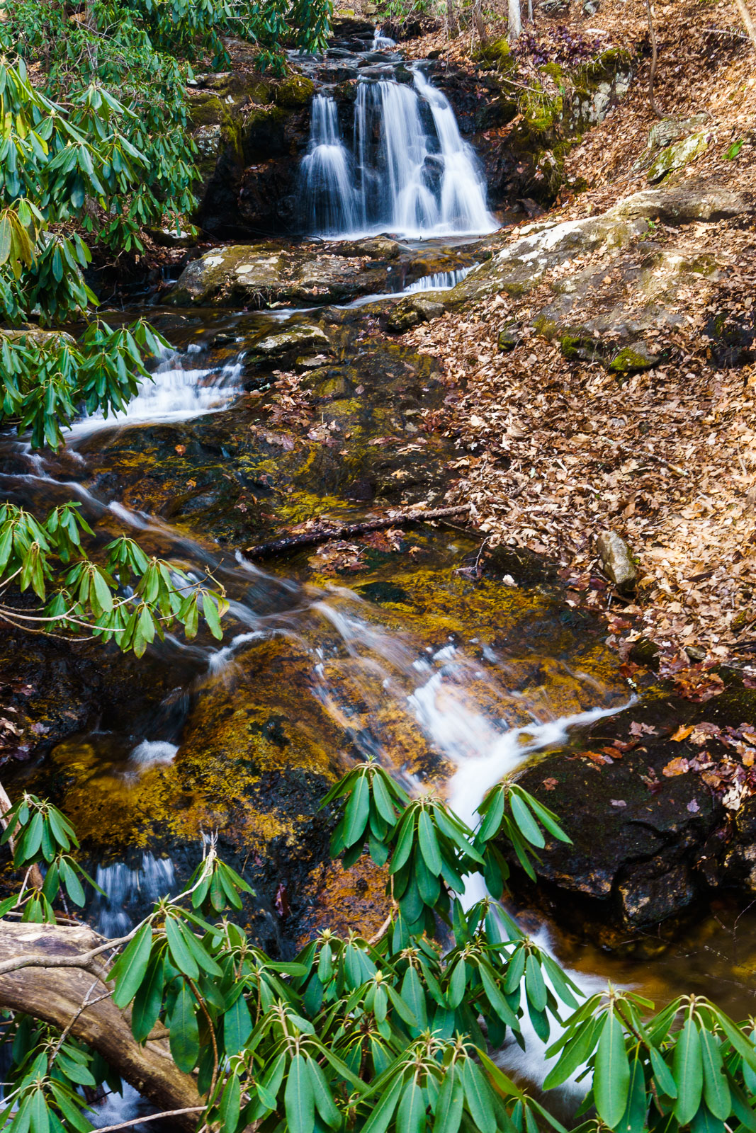
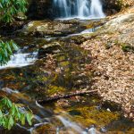
Since I was alone today, I decided to check it out. And indeed, there is another waterfall.
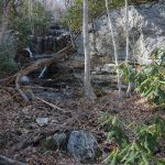
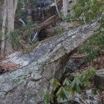
Like the waterfall on Wolf Branch, this one has a low flow. But in higher water, it would look very neat. I’m estimating it’s about 30 feet high, in several free-falling sections over ledges. Below the falls a large boulder sits in the drainage, with a sharp ledge jutting out from it into thin air. It looks like it slid down from the cliff above some eons ago, or over the eons, perhaps. I stood on top of it to take this photo.
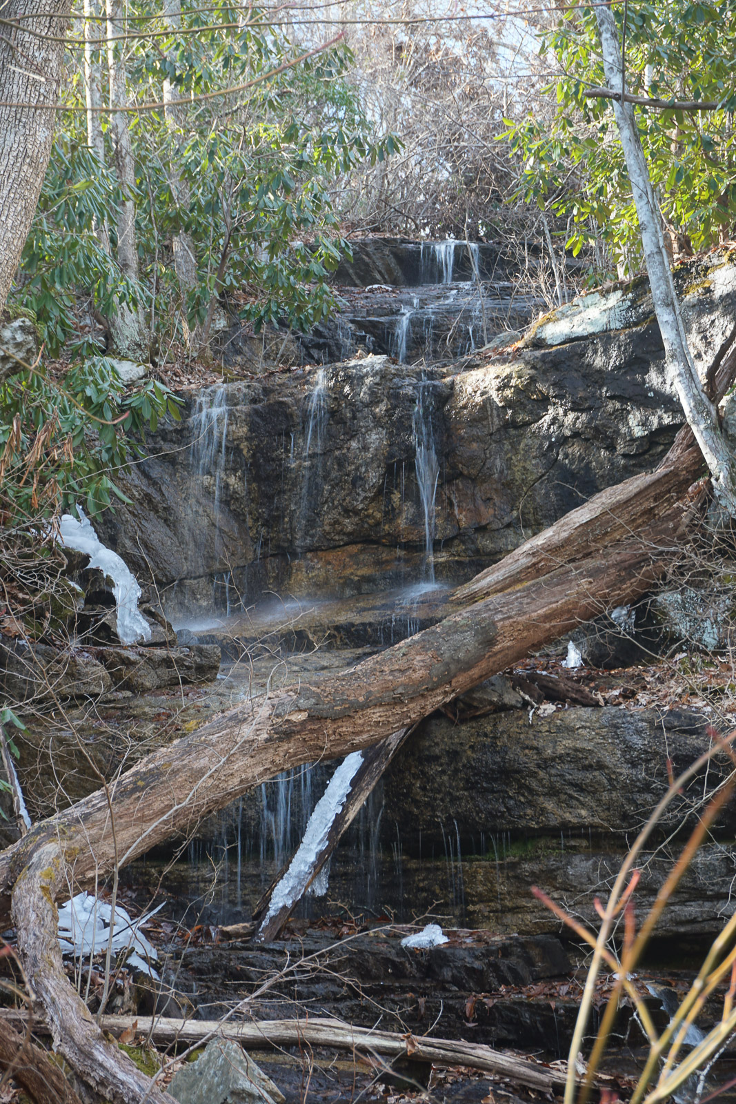
Unlike the waterfall on Wolf Branch, which seems to be getting more word-of-mouth publicity than this blog will ever contribute and darn near has a trail to it already, there was absolutely zero evidence that anyone had ever been to this one. Not recently, anyway. For that reason, I won’t describe exactly how I got to it. The hard-core waterfall hunter will find enough clues in this post to work out where it is. If that doesn’t describe you, don’t bother with it.
I seriously doubt this waterfall has a name. The tributary to Wolf Creek that forms the falls is unnamed, but it sits below a mountain called High Swan – which is a cool name itself. So if I had to pick a name for it – and let’s say I do for the sake of disambiguation – I’m calling it High Swan Falls. At least until I hear that someone has already named it otherwise.
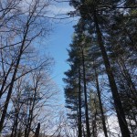
From there, I returned to an unmarked trail heading northwest off the logging path, which winds its way over to one of the main forest roads in Shope Creek (FS 220A). This unofficial trail is relatively level and passes through a neat grove of Eastern White Pine. These are the trees that the Forest Service was removing during the last logging project, since they were planted at some point in the past and have a monoculture effect in dense stands. But I think they’re grand, and these suckers get huge. I’m glad they left some.
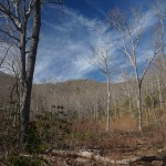
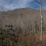
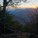
Next, I headed up to the logging cut at the end of FS 220A. From there, a great view opens up of the mountains to the north, including the peak of Lane Pinnacle – the highest mountain in the area, up above the Blue Ridge Parkway. It’s the pointy one just to the right of center in this photo.
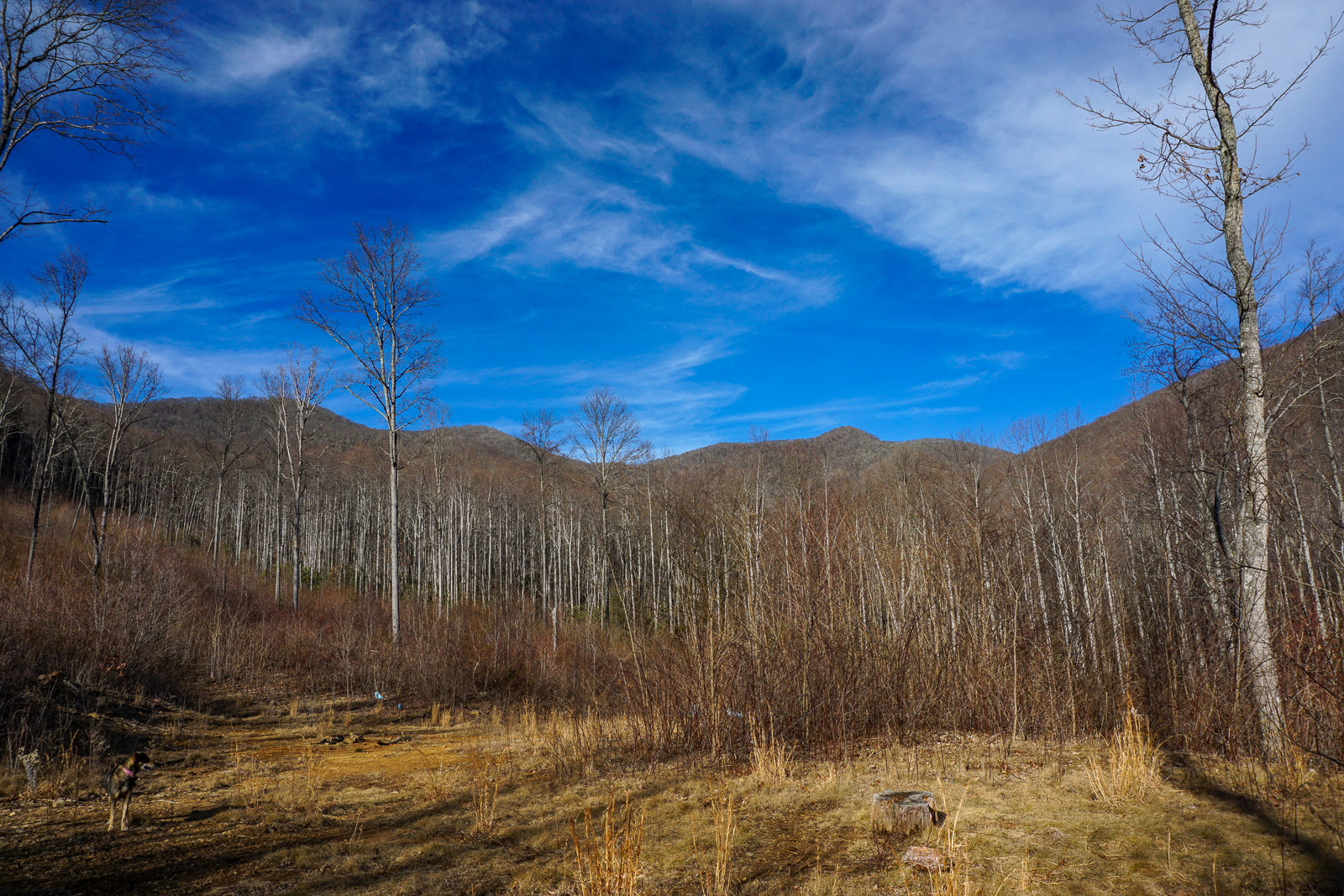
(Incidentally, this end of the road is where I expect other end of that “Gecko Loop” trail I mentioned in last week’s post to pop out when it’s “done”. Ask me how I know.)
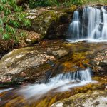
My hike eventually took me up the mountain in the far right of this photo, but my next destination was one I’d been to several times before: Forrest Falls, a pretty little cascade on Shope Creek itself. From the logging cut, I descended FS 220A to find the unmarked trail heading northeast (a right turn if you’re coming uphill). It crossed the west tributary of Shope Creek after just a short distance.
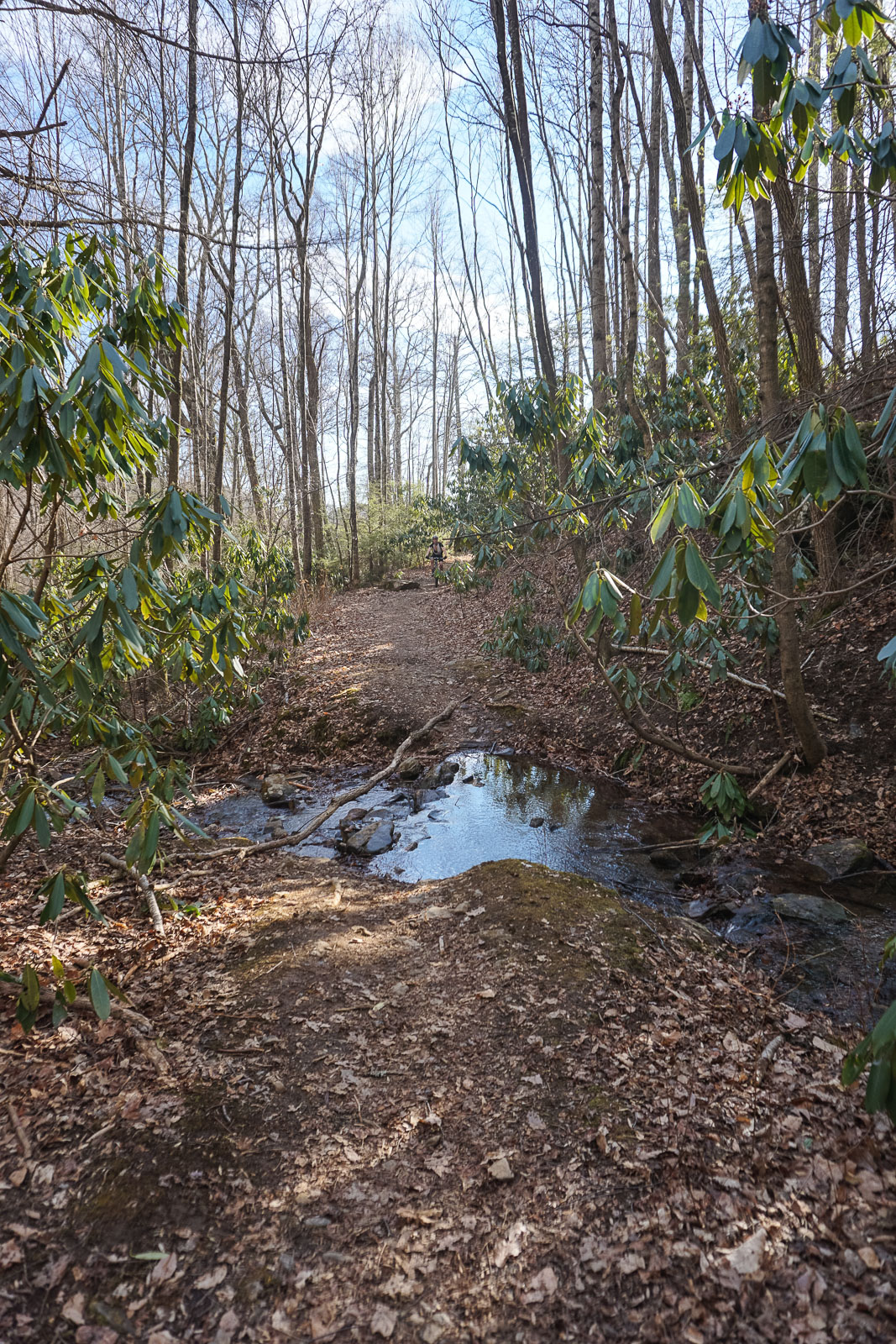
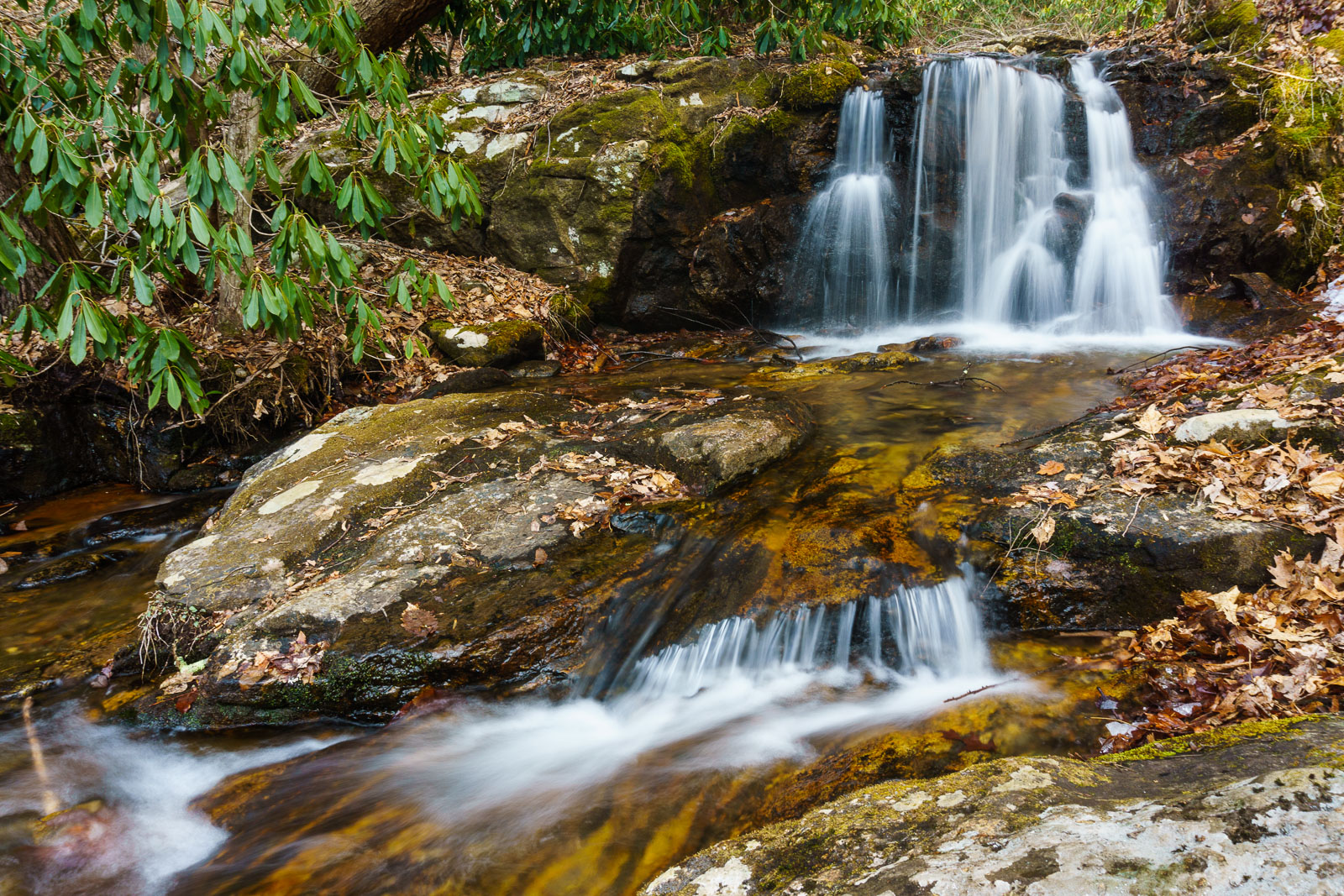
From there, the eroded old road heads up the spit of land between Shope Creek and this western tributary, before a narrower old road angles to the right toward Forrest Falls. It’s just a short distance more to the merry little cascade, maybe only 10 ft. high but attractive nonetheless.
I’ve seen several references to Forrest Falls as the name for this one on the Interwebs, and it looks like Carolina Mountain Club members named it that after Dr. Tim Forrest, who is a Biology professor at UNCA, so I’ve always used that name myself. The Forest Service tasked Dr. Forrest with implementing an aquatic insect monitoring program in Shope Creek in their Environmental Assesment of the Shope Creek project. Giving the falls this name, after someone who cares enough about the environment here to have their name attached to a Forest Service plan for the area, is quite appropriate in my opinion!
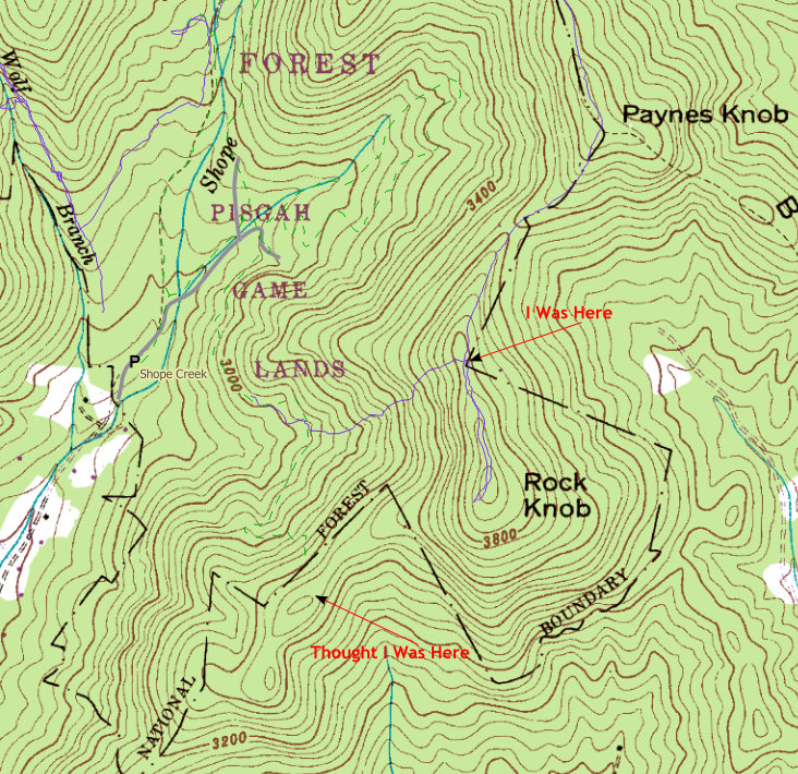
Now, the exploratory portion of my hike really began. I wanted to go further up Shope Creek, because I’d heard that it’s really nice above Forrest Falls, and I wanted to see if I could reach the eastern ridge that lines the Shope Creek drainage to make a loop hike – essentially this hike described by the Carolina Mountain Club. I had previously been up the southern end of that ridge to Rock Knob via an old logging road, and maps and firsthand accounts told me that a trail ran along the ridge connecting the two. I reckoned I would have enough time to complete the loop and get back to my car before sunset.
So, heading upstream on the trail that veers left just past the creek crossing at Forrest Falls, I started seeing for myself how true those reports were. Dead hemlocks notwithstanding (but still standing?), the area is beautiful, and the crystal-clear, merry tumbling waters of Shope Creek kept Darla and I company as we ascended. It was quite motivational.
Before long, the trail veered right into a side cove with a smaller stream flowing out of it. Then it wound its way up to another old logging road bed. Great – this must be the one I’d seen on the map that leads up to the top of the ridge. I turned right. It was heading in the right direction, so I kept following it. And, after a long, arduous slog up the fall-line path, I did indeed end up on top of the ridge. A trail there went both directions, also as I expected – north toward the Blue Ridge Parkway and Lane Pinnacle, and south toward Rock Knob and the trail coming up to it that I’d explored several times.
Now, I had a decision to make. Should I return the way I’d come (BORING!) or follow the ridgeline south to make a loop hike (Yup!). So I started south on the little-used but obvious trail, climbing (what I thought was) Paynes Knob.
It’s worth mentioning that the landscape in this vicinity, along with its wintertime views, is gorgeous. I was high enough that pockets of snow remained in shaded areas from the weather we got earlier in the week, surviving the now 60-degree temperatures. You really start to feel like you’re way out in the mountains when you get into this part of the forest! It kept me moving.
I should also note that I was doing all my navigation by memory. I’ve stared at the map of Shope Creek so much that I was pretty sure I knew were I was going. (Isn’t that funny?) And, as a backstop, I did have my GPS with me. I never use it for navigation – only recording my track – but I always felt it to be a kind of insurance policy if worst came to worst. So without much deliberation, or even a glance at the clock, I plodded along, with the warm Feburary sun on my face.
Before long, the trail started downhill. It was a mite steep, and my knees were not too happy with me by now, but I had plenty of energy and couldn’t believe how gorgeous it was. Views of the surrounding mountains in all directions, lichen and moss covered rocks between patches of crusty old rhododendron and mountain laurels, twisty old trees – even pockets of healthy, beautiful Carolina Hemlocks. This hike was absolutely great!
The trail bottomed out, and I (thought that I) had one more wee mountain to cross (Rock Knob) before heading downhill again, into the gap where I’d expected to find my turn off. So up I went. And then, as I summited into a grove of beautiful, stately Carolina hemlock trees, a gorgeous, bluff-top overlook appeared, with gnarly limbs on all sides, perfectly framing…
Hmmm. A beautiful sunset.
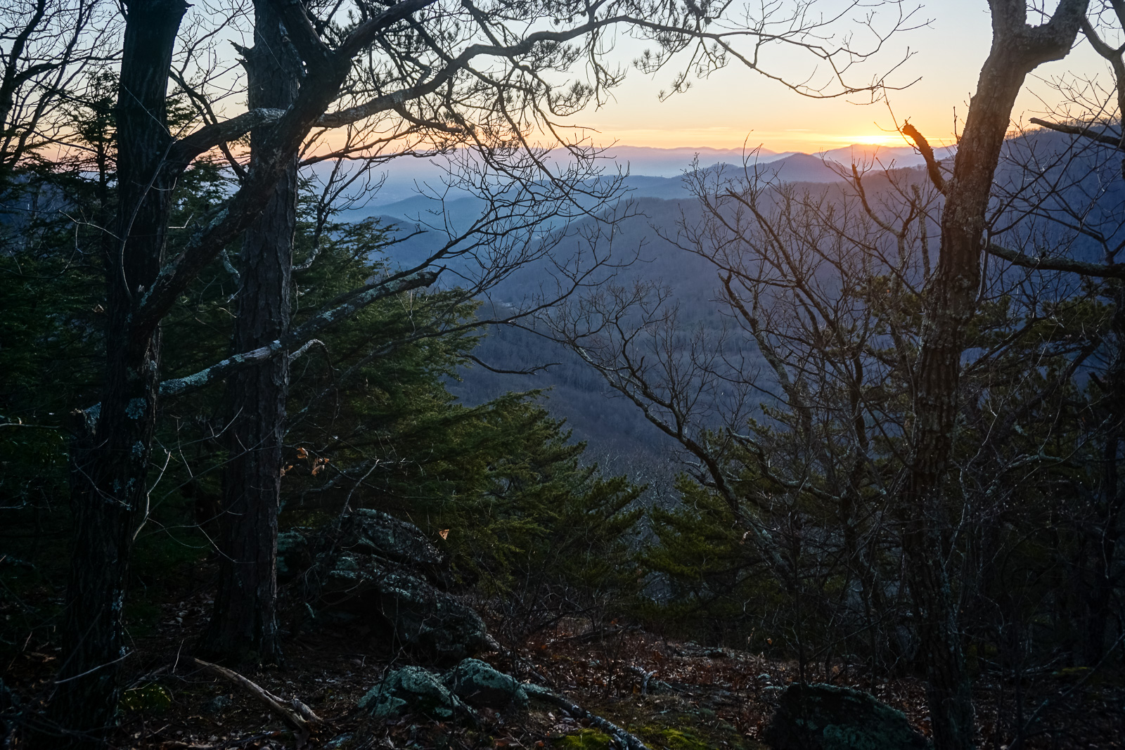
Wait. Sunset? As soon as I took this picture, removing my sunglasses, I realized that I wasn’t quite expecting to catch the sunset up here. It was getting a bit late. I hadn’t noticed how low the sun was getting until it literally disappeared. I had expected it to maybe go down before I got back to my car, but here I was, still standing up on top of Rock Knob (so I thought). No problem – I was almost back to my turn-off. Better pick up the pace! It was all downhill from here anyway.
Down again the other side I went, faint clouds on the horizon glowing bright orange and similarly-colored lights beginning to wink on in the valley miles ahead. I was still feeling great. But I was starting to wonder if I’d make it home in time for dinner.
I decided to see if there was any cell phone reception, so I could send my wife a quick text letting her know that I’d be late. So I whipped out my trusty device, and found that I had two bars of signal. But the icon right next to that? Yeah, the cylinder with the tiny red strip at the bottom with the exclamation point superimposed? It told me battery was very nearly dead. Dang it! The crummy old phone’s screen tends to come on by itself inside my pocket, chewing through the power.
As I shuffled clumsily along, gaping at the screen and navigating the trail with nothing but my peripheral vision, I deliberated whether to see if it had just enough juice to squeeze out a text, before deciding it probably wasn’t neecessary. My wife knows that sometimes I’m out a bit later than I expect and plus, I was only about 20 minutes away from the car.
And then, as I re-pocketed the phone and once again became aware of my surroundings, I noticed that the trail had gone all the way through the next gap. And had started climbing again. In earnest.
Now, this was strange. In my mental map, I should have already reached the turn-off trail down the ridge toward that old logging road. I continued climbing, still looking for the trail off to the right. But why was I having to go UP so much? I didn’t remember the junction being on a climb. More beautiful overlooks appeared, easing my mood a bit, but adding to the confusion. I continued on. It must be just up ahead!
Trudging forward, and up, I remember telling myself – or maybe my dog, I’m pretty sure I said it out loud – that there must’ve been a little elevation gain between the gap and the turn-off. Although I expected to be halfway down the steep part of the other trail by now, there was no sense in complaining to myself about a little work this far in. Before I knew it, I was able to stop my huffing and puffing because I’d reached another rocky summit.
And then, just past the summit, the trail stopped.
“No. This can’t be right”, I remember saying to the trees. Had I overshot the turnoff while I was messing with my phone? Was I off on an adjacent ridge somehow? I was, for the first time ever in my hiking life, starting to doubt that I knew exactly where I was. I stood there, almost positive that I was one mountain farther south than my turn-off should’ve been.
Just like that. A dead-end. It had become a well-worn path by that point, so it was obvious that many people had been up this way before. Myself included, of course! I mean, right? But why hadn’t I found the turn-off I was looking for? Where did all these people come from?
No, actually. This wasn’t right.
I went back the way I came, looking for a trail junction. Light was failing fast; there was only just enough visibility to continue on without some kind of light source. 15 to 20 minutes tops. I must have passed my turn off! My best option was still to find that trail, and descend quickly. I’m always prepared for an unexpected night out in the woods, but I wasn’t hoping for it right now. It was supposed to be a date night with my wife, after all!
5 minutes later, I still thought I was headed back toward the turn-off. It would be on my left now. But the trouble was, it was getting dark enough that I might not see the junction even if I did pass it. I mean, I already missed it on the way up, right? As I passed under some mountain laurels, which shaded out what little twilight remained, the trail basically started to blend in to its surroundings. No problem – now it was time to break out the flashlight.
No problem, that is, until I reached into the side pocket of my pack where I always keep my little waterproof LED light…and realized it wasn’t there. It must be in my other pack!
Great.
That’s when the first real bit of worry started to creep into the back of my mind. It was going to be very dark, very soon. I panicked for a second when I thought about my phone. I pulled it out, intending to yank the battery, hoping to save whatever small amount of juice was left. Maybe I could fire off that text after all, with my coordinates, if I ended up in a true emergency.
Alas, it was too late. The battery was dead. I pulled it out anyway.
Now it was time to stop again and really assess my situation. If I was camping out, I would like to have have been setup by now – or at least have a spot picked out. I forced myself to sit down on a rock, to think, if only for 60 seconds. I had some food – that wasn’t a problem. Plenty of water. Matches, first aid stuff. A little dog food. The weather was nice, but it was going to get cold up here, and I didn’t bring anything but a light fleece. It would be a long, cold night.
It almost seemed a bit comical in my mind. I was no more than 3/4 mile as the crow flies from the parking area (ignoring the 1000 vertical feet down as well). You could stretch a zip line that far and be there in 2 minutes. It’s not like this was some big wild wilderness. Heck, there was a house just off the ridge a quarter mile back – not that I could get to it either, in the pitch black. Was I really going to get stuck up here like this?
Maybe it would only be for a few hours, until the rescue squad my wife would invariably call on me would find my car and start searching. (I wasn’t sure if that was comforting, or completely humiliating.) Still…I wasn’t going to die or anything horrible like that. Not by staying put.
But…where the heck was I?
I pulled out the GPS again, and fumbled with its terribly slow, coarse grained map on the tiny screen. Every time I moved the cursor, it took precious seconds to rebuild the image – seconds I didn’t have; stars were starting to appear in the crystal-clear winter sky now. As the contour lines slowly filled themselves in and I was able to deduce my position from their whirly shape, I could finally see the error of my ways.
I had expected to have to cross 2 summits – Paynes Knob and Rock Knob – from where I’d climbed up the ridge to where I took the turn-off. But in reality, there are 3 summits in that stretch of the ridge. The first, which I thought was Paynes Knob, is unnamed. The second, where I caught the sunset, was actually Paynes Knob, and I was now sitting on Rock Knob. The turn off was still in the gap to the south of me, and I couldn’t even see well enough to find the trail leading down that way!
Ouch.
I continued walking back north, blinking to try and see the trail. But as I neared the gap between Rock and Payne’s Knobs again, I realized that this wasn’t going to work. I started looking for acceptable spots to bivouac, and stopped in a relatively flat, open area with some rhododendron patches to my north and south. Maybe this could work. There was a stiff, cooling, southerly breeze flowing across the gap, though. Ugh.
I pulled out the GPS again one last time to peer at its crappy little map. Neither the trail I was on, nor the one I was looking for, were on this map. But the logging road the trail connects to (and which connects me back to my vehicle) was. And it was exactly – “only” – 1/3 of a mile away.
Straight down the mountain.
At the point where I’d stopped, the forest was open, with a clear western view. There was just enough light left for me to sort of deduce that the open forest continued down the slope, and distinguish open leafy areas from trees and darker blobs of rhododendron and mountain laurel. Or maybe rocks, I don’t know. But…could I make that? 1/3 of a measly mile? If I could just get onto that road, I’d be golden.
On the other hand, if I twisted an ankle, impaled myself on a stob, or tumbled off a rock face halfway down, I’d be toast. No flat ground to rest on. Not close to any trail if someone did happen to come along. And Darla is no Lassie. (Sorry girl! I still love you.)
Obviously, if you looked at that map above (purple was my route), you’ll see that I made a last-millisecond decision I wouldn’t necessarily recommend to anyone, especially if you have no off-trail experience around here.
So there I went – directly down the mountain. It was dark enough now that I couldn’t really see smaller branches or trees as I ran in to them. Darla, sensing that something was amiss, stayed close as she could behind (above?) me.
Steeper than a mule’s face, as they say. You don’t realize how serious these mountains can be until you really get in to them. I started on a trajectory down a low ridge; rhododendrons and rock outcrops kept forcing me to angle to my left, into a shallow cove. Not the optimal route. It was so steep, I was basically skidding and sliding my way down with a growing pile of (thankfully) soft leaves forming a small avalanche in front of me. A few stones and small logs, but nothing serious I was forced to cross. Soon, the extremely steep section gave way to a slightly more gentle bottom area. I sensed a dark patch up ahead.
Rhododendrons. Dang it!
If you’ve never clambered thorough a rhododendron patch – well, it can be like trying to break out of vegetation jail. Thick, tangled limbs slapping you in the face, catching on every protruding body part and part of your pack…it’s not fun even in broad daylight. But as it was, I could no longer make out individual branches, much less which bush they were connected to in order to unweave them from in front of me.
Another quick look at the GPS showed me I was extremely close to the road. No more than 100 feet remained. I had to keep going. So I pushed through – I had to basically allow my weight to break me through the branches at times, hoping ground was present on the other side and not the thin air of some precipice. I clutched at them wildly as they clutched back at me. A calm person watching from below would’ve had a good laugh, I’m sure.
And then…my feet fell on flat ground. By bending over, I could barely make out a strip of darker soil running perpendicular to the crazy steep slope in both directions. This was it! The logging road! I was back on a familiar path!
Relieved, I stopped to take a breather, and even laugh a little. Yes, I still had some hiking to do to get out of there – I was maybe a mile by trail from the car. But I was now confident that I would not be spending the night on this danged mountain.
Incidentally, this is how Dr. Elisha Mitchell – and I share his last name, eerily enough – died, just a few miles north of here on the mountain and waterfall that now bear his name. Scrambling down the mountain. Too bad this mountain already has a name. (I have to wonder, though…Rock Knob? Really? Those old timers could have been a little more creative with their names, or maybe it was given by 6th graders, reflecting their idea of something humorous. Either way, Mount Mitchell Jr. sounds a lot better to me. Alas, I survived…this time!)
One last glance at the GPS map told me I was indeed on the road, and sparked an idea for substituting my missing flashlight: the glow of the screen provided just barely enough light to distinguish the muddy trail from the leaves on either side, and keep me from tripping over larger rocks and logs. This would not have worked on anything but the easiest of paths, but luckily that’s all I had left to navigate. I’m sure I looked like a real tech-dependent touron glowing my way down the trail like that, but hey, it worked. And there was sure as heck no one else there to see me.
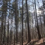
I turned off the GPS tracking to save battery. And I was outta there! Over the last familiar creeks, pits of mud, and that concrete low water crossing (with some nicely arranged stepping stones – I didn’t even get wet feet! Ha!). Finally, down the wide stretch of FS 220 through the tall pines, and then around the gate, back to the car.
I guess it’s true what they say – getting lost can happen to anyone, even the most outdoors-experienced people alive. (“But I wasn’t lost. Just a little above where I needed to be!”, I keep telling myself.)
So yes, I was offered a surprise there in Shope Creek: a surprise mountain, as it were, and a reminder that – once the sun goes down, the click is ticking. Frankly, I got very lucky. I’ve got plenty of experience doing stuff like that, but it’s still just not something you want to be doing at darn near dark thirty when you’ve not prepared for it. And what if the weather had been worse? I’ve never had to bail off a hike like that due to lack of time, and I’m going to make darn sure it never happens again.
I do not recommend replicating my poor judgment if you should find yourself in this situation. Help could have probably been up there in 15 minutes flat on ATV’s. And I know for sure my wife would’ve called someone on me because she told me she was about to when I finally phoned her at 7:30 🙂
Do give Shope Creek a visit if you get the chance. I’ll never forget this little “adventure”, but I won’t stop exploring the area until I’ve been on every little path and trail that exists up there. Although it won’t deter me, you can bet I’ll make darn sure I follow all of the basic rules when I’m hiking from now on, to a T:
- Have a plan, and tell someone where you’re going, and when you’ll be back. Thankfully, I did do this.
- Carry enough provisions for an emergency night out on the trail. I was close, but could’ve stood to have a space blanket or the like in my pack. I’m going to get one now, and I may have stayed put and wound up on the news if I’d had it.
- Carry a paper map, and a flashlight for goodness sake (or better yet, a headlamp). Or both, for backup. GPS and cell phone tech just isn’t there yet, but bring those along too because they’re super convenient when they do work.
- Allow plenty of time for your hike. More than you think you’ll need. Really.
- If you do become lost, or, you know, “above where you really should be”, stop and take stock, like I did. But don’t be a fool like me and stay put! If you have communicated your plan to someone, you’ll be much safer allowing help to come to you than trying to rescue yourself.
- Seriously. Just because I jumped off a mountain, that doesn’t mean you have to too, now does it?
Now, I’ve got to go figure out where that darn trail coming off Rock Knob is!
[map style=”width: 100%; height: 400px;” gpx=”/wp-content/uploads/2015/02/2015-02-07-Shope-Creek-Waterfalls-and-Loop.gpx”]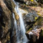
9 Responses